
IMAGES TAKEN NEAR TO
Timsbury Bottom, BATH, BA2 0EZ
Introduction
This page details the photographs taken nearby to Timsbury Bottom, BA2 0EZ by members of the Geograph project.
The Geograph project started in 2005 with the aim of publishing, organising and preserving representative images for every square kilometre of Great Britain, Ireland and the Isle of Man.

There are currently over 7.5m images from over14,400 individuals and you can help contribute to the project by visiting https://www.geograph.org.uk
Image Map
Images are licensed for reuse under creativecommons.org/licenses/by-sa/2.0
Notes
- Clicking on the map will re-center to the selected point.
- The higher the marker number, the further away the image location is from the centre of the postcode.
Image Listing (8 Images Found)
Images are licensed for reuse under creativecommons.org/licenses/by-sa/2.0
Image
Details
Distance
1
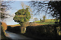
Road, Timsbury Bottom
Looking the other way from Image Opposite the entrance to Timsbury Bottom Farm is the start of two footpaths off to the right, CL 21/30 and CL 21/29.
Image: © Derek Harper
Taken: 9 Dec 2019
0.02 miles
2
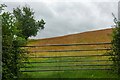
High Littleton : Grassy Field & Gate
A field seen from Bungay's Hill.
Image: © Lewis Clarke
Taken: 11 Jul 2023
0.05 miles
3
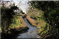
Bungay's Hill
Climbing from Timsbury Bottom towards High Littleton. The lane crosses a stream by the little bit of fencing on the left. In doing so it crosses the parish boundary between Timsbury (this side) and High Littleton. Image] looks the other way from here.
Image: © Derek Harper
Taken: 9 Dec 2019
0.07 miles
4
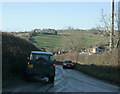
2009 : Ice on Bungay's Hill
A north facing steep hill on the minor road between Timsbury and High Littleton.
That "water" is black ice, even the driver of the Landrover was very careful. The driver of the car coming up was keeping his nearside wheels as close to the side as possible but only just made it.
This geographer suddenly remembered some important things he had to do at home.
Image: © Maurice Pullin
Taken: 20 Dec 2009
0.11 miles
5
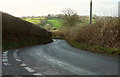
Bends on Loves Hill
The road from Timsbury to Timsbury Bottom passes a track on the left to Withy Mills and Dunsford Farms. The road can be seen ahead on Bungay's Hill across the valley.
Image: © Derek Harper
Taken: 9 Dec 2019
0.12 miles
6
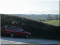
2009 : At the top of Bungay's Hill
On the minor road between Timsbury and High Littleton.
Image: © Maurice Pullin
Taken: 20 Dec 2009
0.14 miles
7
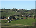
2009 : A look into Timsbury Bottom
Timsbury Bottom Farm is down the hill with High Littleton peering over the next ridge.
The area is riddled with old mine workings.
Image: © Maurice Pullin
Taken: 20 Dec 2009
0.18 miles
8
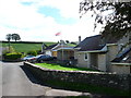
Houses on Priorshill
These houses are at the bottom of Priorshill where it joins Loves Hill. Priorshill rises up to the hamlet of Tyning
Image: © Nigel Mykura
Taken: 18 Sep 2011
0.22 miles