
IMAGES TAKEN NEAR TO
Highbury Villas, BATH, BA1 6DT
Introduction
This page details the photographs taken nearby to Highbury Villas, BA1 6DT by members of the Geograph project.
The Geograph project started in 2005 with the aim of publishing, organising and preserving representative images for every square kilometre of Great Britain, Ireland and the Isle of Man.

There are currently over 7.5m images from over14,400 individuals and you can help contribute to the project by visiting https://www.geograph.org.uk
Image Map
Images are licensed for reuse under creativecommons.org/licenses/by-sa/2.0
Notes
- Clicking on the map will re-center to the selected point.
- The higher the marker number, the further away the image location is from the centre of the postcode.
Image Listing (79 Images Found)
Images are licensed for reuse under creativecommons.org/licenses/by-sa/2.0
Image
Details
Distance
1
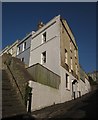
Highbury Terrace, Bath
http://www.britishlistedbuildings.co.uk/en-446023-1-8-bath suggests that this stepped terrace perched above Snow Hill dates from the 1820s.
Image: © Derek Harper
Taken: 11 Feb 2012
0.03 miles
2
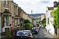
Snow Hill
A steep and narrow residential road descending towards Bath.
Image: © Bill Boaden
Taken: 25 Jul 2016
0.04 miles
3
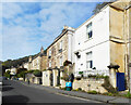
Camden Road, Bath
An area of quite old housing with steep roads and terraces following the contours.
Image: © Des Blenkinsopp
Taken: 10 Sep 2020
0.05 miles
4
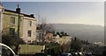
Frankley Buildings, Bath
"Circa 1800-20 terrace stepped up hill" http://www.britishlistedbuildings.co.uk/en-445626-frankley-house-bath ; an interesting arrangement with four houses in the centre being two-storey, the rest three-storey. A great view from this area over the Avon valley.
Image: © Derek Harper
Taken: 11 Feb 2012
0.06 miles
5
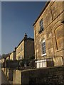
Claremont Place, Bath
Another view of the pairs of sunny C19 semis shown in Image
Image: © Derek Harper
Taken: 11 Feb 2012
0.06 miles
6
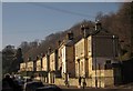
Claremont Place, Bath
"Pairs of semi-detached villas in good position facing south" http://www.britishlistedbuildings.co.uk/en-442387-5-12-bath , on Camden Road. The houses date from the early C19.
Image: © Derek Harper
Taken: 11 Feb 2012
0.06 miles
7
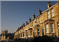
Hanover Terrace, Bath
The terrace is numbered 1-15. Opposite is Gillingham Terrace, numbered 1-11. So there are two number ones on the same road, and so on. Except the road itself doesn't seem to have a name! The canted bays, common in this neighbourhood, give a smart appearance to the terrace.
Image: © Derek Harper
Taken: 11 Feb 2012
0.06 miles
8
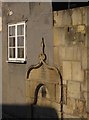
Drinking fountain, Tyning lane, Bath
This old blocked fountain, carrying the text from John 4 ("Whosoever drinketh of this water, shall thirst again ...") symbolises our fruitless search for refreshment on a Saturday morning; two cafes closed, one permanently, and a pub that hadn't yet opened.
Image: © Derek Harper
Taken: 11 Feb 2012
0.07 miles
9
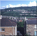
Houses on Highbury Place
Looking south-east from Arundel Road over the rooftops of Highbury Place and other roads down to the large Georgian houses on London Road. Across the valley is Bathampton Hill with the government office blocks at the Warminster Road site on the right.
Image: © Trevor Rickard
Taken: Unknown
0.09 miles
10
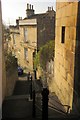
Steps to Brunswick Street, Bath
Image: © Derek Harper
Taken: 11 Feb 2012
0.09 miles