
IMAGES TAKEN NEAR TO
Belgrave Crescent, BATH, BA1 5JU
Introduction
This page details the photographs taken nearby to Belgrave Crescent, BA1 5JU by members of the Geograph project.
The Geograph project started in 2005 with the aim of publishing, organising and preserving representative images for every square kilometre of Great Britain, Ireland and the Isle of Man.

There are currently over 7.5m images from over14,400 individuals and you can help contribute to the project by visiting https://www.geograph.org.uk
Image Map
Images are licensed for reuse under creativecommons.org/licenses/by-sa/2.0
Notes
- Clicking on the map will re-center to the selected point.
- The higher the marker number, the further away the image location is from the centre of the postcode.
Image Listing (112 Images Found)
Images are licensed for reuse under creativecommons.org/licenses/by-sa/2.0
Image
Details
Distance
1
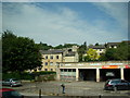
Bath hillside terrace
Looking north-northwest from a Bath-bound National Express Coach passing Kwik Fit on the A4.
Image: © Robert Lamb
Taken: 31 Jul 2011
0.05 miles
2
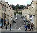
Thomas Street, Bath
Thomas Street is a 135 metre long cul-de-sac on the NW side of the A4 London Road.
Image: © Jaggery
Taken: 24 Sep 2011
0.07 miles
3

Houses on the hillside, viewed from the A4
Taken looking north-northwest from a Bath-bound National Express coach.
Image: © Robert Lamb
Taken: 31 Jul 2011
0.09 miles
4

Berkeley House, Snow Hill, Bath
Dominating this view north along Snow Hill from the A4 London Road
end is the 11-storey block of flats named Berkeley House.
Image: © Jaggery
Taken: 24 Sep 2011
0.10 miles
5
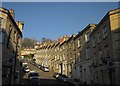
Thomas Street, Bath
A no through road climbing steeply off the London Road, with a stepped terrace on its northeast side.
Image: © Derek Harper
Taken: 11 Feb 2012
0.11 miles
6

Thomas Street
A residential street climbing steeply up the hillside.
Image: © Bill Boaden
Taken: 25 Jul 2016
0.11 miles
7

Terrace of houses above Camden Road Walcot
Image: © Rod Allday
Taken: 4 Mar 2013
0.12 miles
8

Bath city centre
View south from Arundel Road to the city centre across the ugly blocks of flats at Snow Hill, which must rate as the top planning blunder here.
Image: © Trevor Rickard
Taken: Unknown
0.12 miles
10

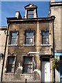
Mark among the railings
A cutmark, as listed in the Benchmark Database: http://www.bench-marks.org.uk/bm53939 , on the supporting wall of the railings in Pera Road. See Image] for a wider view.
Image: © Neil Owen
Taken: 7 Jan 2014
0.13 miles