
IMAGES TAKEN NEAR TO
Hebden Road, BRADFORD-ON-AVON, BA15 2BX
Introduction
This page details the photographs taken nearby to Hebden Road, BA15 2BX by members of the Geograph project.
The Geograph project started in 2005 with the aim of publishing, organising and preserving representative images for every square kilometre of Great Britain, Ireland and the Isle of Man.

There are currently over 7.5m images from over14,400 individuals and you can help contribute to the project by visiting https://www.geograph.org.uk
Image Map
Images are licensed for reuse under creativecommons.org/licenses/by-sa/2.0
Notes
- Clicking on the map will re-center to the selected point.
- The higher the marker number, the further away the image location is from the centre of the postcode.
Image Listing (18 Images Found)
Images are licensed for reuse under creativecommons.org/licenses/by-sa/2.0
Image
Details
Distance
1
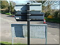
Boswell Road backwards
An embossed sign gives a different texture to the road network in Westwood.
Image: © Neil Owen
Taken: 29 Mar 2021
0.06 miles
2
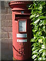
Pillar box in Westwood
A little sun-faded but still a priority box. This and others in the village have a personalised message from the grateful populace: 'Thank you for keeping us connected'.
Image: © Neil Owen
Taken: 29 Mar 2021
0.09 miles
3
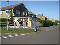
The post office and shop on Tynings Way
A small village is Westwood, no need for a large supermarket.
Image: © Neil Owen
Taken: 29 Mar 2021
0.09 miles
4
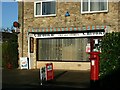
2007 : Westwood Post Office & Stores
The Post Office and stores in Bobbin Lane.
Village Stores
Image: © Maurice Pullin
Taken: 29 Oct 2007
0.10 miles
5
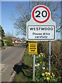
Slow through Westwood
On top of the speed limit, there is single traffic through the main road. Gas pipelilnes are being upgraded.
Image: © Neil Owen
Taken: 29 Mar 2021
0.13 miles
6
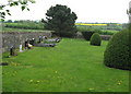
Westwood cemetery
The cemetery is detached from the church and quite difficult to find without a map!
Image: © Nick Smith
Taken: 18 Apr 2011
0.15 miles
7
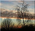
2007 : Morning
A few minutes before sunrise on a very cold morning.
Image: © Maurice Pullin
Taken: 12 Dec 2007
0.17 miles
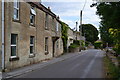
9
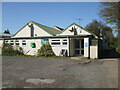
Westwood Social Club
The village has had a hall here for community use for around a century.
Image: © Neil Owen
Taken: 29 Mar 2021
0.18 miles
10
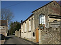
Orchard Close, Westwood
The building to the right is the former Particular Baptist chapel, dating back to the nineteenth century. Local friends met in various houses in the early 1800s, before sufficient money was raised to found this in 1865.
Further on to the left is the hall and former Sunday school.
The church and education were closely combined initially: a Sunday class was established in the chapel in 1871, but when the opportunity arose the new hall and school was built in 1885. Later, the school welcomed infants on a more regular basis but was succeeded after WWII. The chapel was sold off and later became a studio in 1978.
Image: © Neil Owen
Taken: 29 Mar 2021
0.19 miles