1
Attractions and twinning, Bradford-on-Avon
The sign low down on the wall of a Trowbridge Road house lists some of the attractions of Bradford-on-Avon : Saxon Church, Chapel on the Bridge, Tithe Barn, St Mary's Tory. Bradford-on-Avon is twinned with Norden (Germany), Sully-sur-Loire (France) and Elbląg (Poland).
Image: © Jaggery
Taken: 7 Oct 2011
0.06 miles
2
Old Milestone by the A363, Trowbridge Road, Bradford on Avon parish
Metal plate attached to stone post by the A363, in parish of BRADFORD ON AVON (WEST WILTSHIRE District), Trowbridge Road; Bradford on Avon; opposite the junction with Moulton Drive, in hedgerow behind pavement, on East side of road. Bath incised iron plate, erected by the Bradford turnpike trust in the 19th century.
Inscription reads:-
To
BATH
9
Milestone Society National ID: WI_BATB09.
Image: © M Faherty
Taken: 22 Nov 2007
0.08 miles
3
Kennet and Avon Canal on edge of Bradford-on-Avon
The built-up area extends to just beyond the hedge on the right
Image: © David Smith
Taken: 9 Jun 2017
0.09 miles
4
Towpath on the Kennet & Avon Canal near Bradford-on-Avon
Image: © Rod Allday
Taken: 20 Jun 2022
0.09 miles
5
The Kennet & Avon Canal, west of Widbrook Bridge
Big boats can use wide canals!
Image: © Christine Johnstone
Taken: 2 May 2015
0.10 miles
6
Bridge 170 on the K&A
Bridge number 170 on the Kennet & Avon canal.
Image: © Stephen Bashford
Taken: 29 Nov 2005
0.10 miles
7
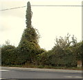
Telephone pole covered in vegetation, Bradford-on-Avon
Viewed across Trowbridge Road, near an ivy-clad house. http://www.geograph.org.uk/photo/3170488
In the lower right corner of the view, an old milestone shows 9 miles to Bath.
Image: © Jaggery
Taken: 7 Oct 2011
0.11 miles
8
A walk from Trowbridge to Bradford-on-Avon [55]
As the Kennet and Avon Canal nears Bradford-on-Avon, there are a number of houseboats moored, including the floating garden seen here.
The walk starts at Trowbridge railway station and initially follows both the railway line and the River Bliss northwards. The river and the railway both pass under the Kennet and Avon Canal and the canal towpath is taken heading west towards Bradford-on-Avon. Leaving the canal, a short walk through streets leads to the railway station for a train back to the starting point at Trowbridge. Just under 3¾ miles.
Image: © Michael Dibb
Taken: 26 Jan 2023
0.11 miles
9
Bradford Town football pitch, Bradford-on-Avon
This is the home venue for Bradford Town FC http://www.geograph.org.uk/photo/3170550 located in
the Bradford on Avon Sports and Social Club site alongside Trowbridge Road.
Image: © Jaggery
Taken: 7 Oct 2011
0.12 miles
10
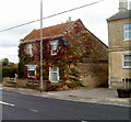
Ivy-clad house, Trowbridge Road, Bradford-on-Avon
Located next door to The Beehive. http://www.geograph.org.uk/photo/3170477
Image: © Jaggery
Taken: 7 Oct 2011
0.12 miles


![A walk from Trowbridge to Bradford-on-Avon [55]](https://s2.geograph.org.uk/geophotos/07/40/61/7406134_6e7c9069_120x120.jpg)

