
IMAGES TAKEN NEAR TO
Conigre Hill, BRADFORD-ON-AVON, BA15 1NJ
Introduction
This page details the photographs taken nearby to Conigre Hill, BA15 1NJ by members of the Geograph project.
The Geograph project started in 2005 with the aim of publishing, organising and preserving representative images for every square kilometre of Great Britain, Ireland and the Isle of Man.

There are currently over 7.5m images from over14,400 individuals and you can help contribute to the project by visiting https://www.geograph.org.uk
Image Map
Images are licensed for reuse under creativecommons.org/licenses/by-sa/2.0
Notes
- Clicking on the map will re-center to the selected point.
- The higher the marker number, the further away the image location is from the centre of the postcode.
Image Listing (705 Images Found)
Images are licensed for reuse under creativecommons.org/licenses/by-sa/2.0
Image
Details
Distance
1
![Bell House [2]](https://s3.geograph.org.uk/geophotos/05/83/36/5833639_e86eabd0_120x120.jpg)
Bell House [2]
With a datestone of 1695, this interesting building gives the appearance of a row of three 18th century houses and it is probable that the fenestration was changed at that time. It was the Bell Inn until it closed in the 1960s and a large bell hung from the bracket above the first floor window. There was once a skittle alley on the top floor. It has been converted into several separate dwellings, although not as the original three houses. Listed, grade II, with details at: https://www.historicengland.org.uk/listing/the-list/list-entry/1184198
Image: © Michael Dibb
Taken: 19 Jun 2018
0.01 miles
2
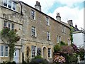
60 & 61 Newtown
Probably late 17th/early 18th century, these two appear to have been refronted in the 19th century. Listed, grade II, with details at: https://www.historicengland.org.uk/listing/the-list/list-entry/1364492
Image: © Michael Dibb
Taken: 19 Jun 2018
0.01 miles
3
![Bell House [1]](https://s2.geograph.org.uk/geophotos/05/83/36/5833638_334d7cca_120x120.jpg)
Bell House [1]
With a datestone of 1695, this interesting building gives the appearance of a row of three 18th century houses and it is probable that the fenestration was changed at that time. It was the Bell Inn until it closed in the 1960s and a large bell hung from the bracket above the first floor window. There was once a skittle alley on the top floor. It has been converted into several separate dwellings, although not as the original three houses. Listed, grade II, with details at: https://www.historicengland.org.uk/listing/the-list/list-entry/1184198
Image: © Michael Dibb
Taken: 19 Jun 2018
0.01 miles
4
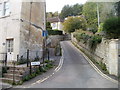
Conigre Hill, Bradford-on-Avon
Conigre Hill climbs away from Newtown.
Image: © Jaggery
Taken: 7 Oct 2011
0.01 miles
5
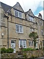
58 & 59 Newtown
Part of a row of late 17th early 18th century houses. The row (53 to 59) is listed, grade II*, with details at: https://www.historicengland.org.uk/listing/the-list/list-entry/1036094
Image: © Michael Dibb
Taken: 19 Jun 2018
0.01 miles
6
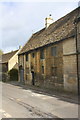
Prior's Close, Newtown
There is an OS benchmark Image on the right hand side of the lower arch
Image: © Roger Templeman
Taken: 31 Mar 2015
0.02 miles
7
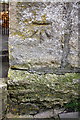
Benchmark on #1A Prior's Close
Ordnance Survey cut mark benchmark described on the Bench Mark Database at http://www.bench-marks.org.uk/bm65864
Image: © Roger Templeman
Taken: 31 Mar 2015
0.02 miles
8
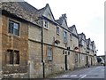
Priory Steps
Six 17th century cottages have been converted into a guest house. The property has been re-faced. Listed (in two parts), grade II, with details at: https://www.historicengland.org.uk/listing/the-list/list-entry/1036080 and at: https://www.historicengland.org.uk/listing/the-list/list-entry/1036081
Image: © Michael Dibb
Taken: 19 Jun 2018
0.02 miles
9
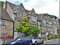
54 to 59 Newtown
Part of a row of late 17th early 18th century houses. The row (53 to 59) is listed, grade II*, with details at: https://www.historicengland.org.uk/listing/the-list/list-entry/1036094
Image: © Michael Dibb
Taken: 19 Jun 2018
0.02 miles
10
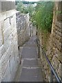
Rosemary Lane
The stepped lane runs from Newtown down to Church Street.
Image: © Michael Dibb
Taken: 19 Jun 2018
0.03 miles