
IMAGES TAKEN NEAR TO
Manor Road, TROWBRIDGE, BA14 9JD
Introduction
This page details the photographs taken nearby to Manor Road, BA14 9JD by members of the Geograph project.
The Geograph project started in 2005 with the aim of publishing, organising and preserving representative images for every square kilometre of Great Britain, Ireland and the Isle of Man.

There are currently over 7.5m images from over14,400 individuals and you can help contribute to the project by visiting https://www.geograph.org.uk
Image Map
Images are licensed for reuse under creativecommons.org/licenses/by-sa/2.0
Notes
- Clicking on the map will re-center to the selected point.
- The higher the marker number, the further away the image location is from the centre of the postcode.
Image Listing (5 Images Found)
Images are licensed for reuse under creativecommons.org/licenses/by-sa/2.0
Image
Details
Distance
1
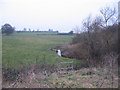
Lambrok Stream
A view looking northwest across the Lambrok Stream towards Arnolds Hill, showing the footbridge carrying the public footpath over the stream.
Image: © Phil Williams
Taken: 4 Feb 2006
0.16 miles
2
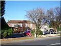
The Farmhouse Inn, Southwick
Built in the 18th century this building was originally a farmhouse before becoming an inn.
Image: © Maigheach-gheal
Taken: 17 Nov 2009
0.23 miles
3

Sign for the Farmhouse Inn
Built in the 18th century this building was originally a farmhouse before becoming an inn. The sign is painted by David Young, resident sign writer at the Wadworth Brewery. David has spent 15 years hand-painting more than 250 signs.
Image: © Maigheach-gheal
Taken: 17 Nov 2009
0.23 miles
4
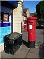
Postbox, Southwick
The George V reign postbox is opposite the Black Horse public house.
Image: © Maigheach-gheal
Taken: 17 Nov 2009
0.24 miles
5
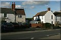
2007 : Cottages on Frome Road, Trowbridge
A small section of what the planners left behind.
Image: © Maurice Pullin
Taken: 29 Nov 2007
0.24 miles