
IMAGES TAKEN NEAR TO
Tyning Close, TROWBRIDGE, BA14 9DZ
Introduction
This page details the photographs taken nearby to Tyning Close, BA14 9DZ by members of the Geograph project.
The Geograph project started in 2005 with the aim of publishing, organising and preserving representative images for every square kilometre of Great Britain, Ireland and the Isle of Man.

There are currently over 7.5m images from over14,400 individuals and you can help contribute to the project by visiting https://www.geograph.org.uk
Image Map
Images are licensed for reuse under creativecommons.org/licenses/by-sa/2.0
Notes
- Clicking on the map will re-center to the selected point.
- The higher the marker number, the further away the image location is from the centre of the postcode.
Image Listing (3 Images Found)
Images are licensed for reuse under creativecommons.org/licenses/by-sa/2.0
Image
Details
Distance
1
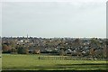
2007 : Farmland and Trowbridge
This view of farmland associated with London Bridge Farm has Trowbridge in the background. St. James Parish Church, Trowbridge Town Hall and Trinity Church are visible.
Image: © Maurice Pullin
Taken: 6 Nov 2007
0.14 miles
2
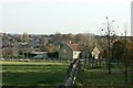
2007 : London Bridge Farm, near Trowbridge
Taken from the farm entrance at the top of Arnold's Hill.
Image: © Maurice Pullin
Taken: 6 Nov 2007
0.18 miles
3
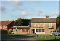
2007 : The John Bull, Studley Green, Trowbridge
A typical housing estate pub, without interest or character.
Apologies to the landlord, I am told it is better on the inside.
To find out what it is really like visit http://www.pisle.com/troweb/pubsnclubs/johnbull.html
Image: © Maurice Pullin
Taken: 29 Nov 2007
0.24 miles