
IMAGES TAKEN NEAR TO
Blease Close, TROWBRIDGE, BA14 8WB
Introduction
This page details the photographs taken nearby to Blease Close, BA14 8WB by members of the Geograph project.
The Geograph project started in 2005 with the aim of publishing, organising and preserving representative images for every square kilometre of Great Britain, Ireland and the Isle of Man.

There are currently over 7.5m images from over14,400 individuals and you can help contribute to the project by visiting https://www.geograph.org.uk
Image Map
Images are licensed for reuse under creativecommons.org/licenses/by-sa/2.0
Notes
- Clicking on the map will re-center to the selected point.
- The higher the marker number, the further away the image location is from the centre of the postcode.
Image Listing (58 Images Found)
Images are licensed for reuse under creativecommons.org/licenses/by-sa/2.0
Image
Details
Distance
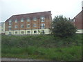
2
![A walk from Trowbridge to Bradford-on-Avon [27]](https://s3.geograph.org.uk/geophotos/07/40/32/7403251_74870767_120x120.jpg)
A walk from Trowbridge to Bradford-on-Avon [27]
Seen from the parapet of Ladydown Aqueduct is the Wessex Main Line railway. In the distance, the single line branch to Chippenham and Swindon goes straight ahead, with the line to Bath curves to the left. The aqueduct is listed but impossible to photograph. Built in the mid 19th century of concrete and yellow brick. Listed, grade II, with details at: https://historicengland.org.uk/listing/the-list/list-entry/1021620
The walk starts at Trowbridge railway station and initially follows both the railway line and the River Bliss northwards. The river and the railway both pass under the Kennet and Avon Canal and the canal towpath is taken heading west towards Bradford-on-Avon. Leaving the canal, a short walk through streets leads to the railway station for a train back to the starting point at Trowbridge. Just under 3¾ miles.
Image: © Michael Dibb
Taken: 26 Jan 2023
0.09 miles
3
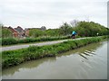
Cyclists on NCR 4, near Hilperton Wharf
Otherwise known as the Kennet & Avon Canal towpath.
Image: © Christine Johnstone
Taken: 2 May 2015
0.12 miles
4
![A walk from Trowbridge to Bradford-on-Avon [23]](https://s3.geograph.org.uk/geophotos/07/40/32/7403215_0787161c_120x120.jpg)
A walk from Trowbridge to Bradford-on-Avon [23]
The Kennet and Avon Canal, looking northeast, from the bridge carrying the footpath.
The walk starts at Trowbridge railway station and initially follows both the railway line and the River Bliss northwards. The river and the railway both pass under the Kennet and Avon Canal and the canal towpath is taken heading west towards Bradford-on-Avon. Leaving the canal, a short walk through streets leads to the railway station for a train back to the starting point at Trowbridge. Just under 3¾ miles.
Image: © Michael Dibb
Taken: 26 Jan 2023
0.12 miles
5
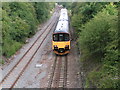
Train to Weymouth, about to go under the Kennet and Avon canal
This is class 150 unit 150129
Image: © Rob Purvis
Taken: 9 Jul 2011
0.13 miles

7
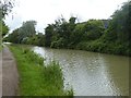
Canal passing factories, Hilperton
Factories hidden behind the trees on the bank
Image: © David Smith
Taken: 9 Jun 2017
0.15 miles
8

Trowbridge : Wessex Mainline
Looking along the railway.
Image: © Lewis Clarke
Taken: 18 Oct 2022
0.15 miles
9
![A walk from Trowbridge to Bradford-on-Avon [29]](https://s2.geograph.org.uk/geophotos/07/40/32/7403258_f7ffcabe_120x120.jpg)
A walk from Trowbridge to Bradford-on-Avon [29]
Seen from the parapet of Biss Aqueduct is the River Biss which flows into the River Avon about half a mile downstream. The aqueduct is listed but impossible to photograph. Built in the early 19th century of ashlar. Listed, grade II, with details at: https://historicengland.org.uk/listing/the-list/list-entry/1364207
The walk starts at Trowbridge railway station and initially follows both the railway line and the River Bliss northwards. The river and the railway both pass under the Kennet and Avon Canal and the canal towpath is taken heading west towards Bradford-on-Avon. Leaving the canal, a short walk through streets leads to the railway station for a train back to the starting point at Trowbridge. Just under 3¾ miles.
Image: © Michael Dibb
Taken: 26 Jan 2023
0.15 miles
10
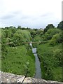
River Biss
Seen from the canal aqueduct
Image: © David Smith
Taken: 9 Jun 2017
0.16 miles