
IMAGES TAKEN NEAR TO
Thestfield Drive, TROWBRIDGE, BA14 8UA
Introduction
This page details the photographs taken nearby to Thestfield Drive, BA14 8UA by members of the Geograph project.
The Geograph project started in 2005 with the aim of publishing, organising and preserving representative images for every square kilometre of Great Britain, Ireland and the Isle of Man.

There are currently over 7.5m images from over14,400 individuals and you can help contribute to the project by visiting https://www.geograph.org.uk
Image Map
Images are licensed for reuse under creativecommons.org/licenses/by-sa/2.0
Notes
- Clicking on the map will re-center to the selected point.
- The higher the marker number, the further away the image location is from the centre of the postcode.
Image Listing (41 Images Found)
Images are licensed for reuse under creativecommons.org/licenses/by-sa/2.0
Image
Details
Distance
2
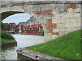
Hilperton Marina entrance from Kennet & Avon Canal
Image: © Ian Murfitt
Taken: 10 May 2015
0.12 miles
3
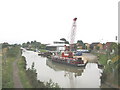
Hilperton Wharf
Hilperton Wharf on the Kennet and Avon canal at Trowbridge, Wiltshire.
Image: © Phil Williams
Taken: 11 Sep 2005
0.13 miles
4

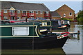
Flats on The Slipway
Seen from a boat on the Kennet & Avon Canal at Hilperton.
Image: © Christine Johnstone
Taken: 2 May 2015
0.13 miles

8
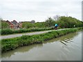
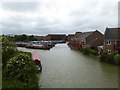
Cyclists on NCR 4, near Hilperton Wharf
Otherwise known as the Kennet & Avon Canal towpath.
Image: © Christine Johnstone
Taken: 2 May 2015
0.14 miles
9
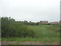
West Wiltshire : Grassy Field & Housing Estate
Image: © Lewis Clarke
Taken: 27 May 2009
0.14 miles
10
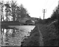
Parsons Bridge, Kennet and Avon Canal, in 1977
Seen from the east. When the bridge was photographed in 1977 it was of little consequence, leading only to agricultural land on the north side of the canal, but since then it has been rebuilt and now the bridge carries a metalled road leading to the marina buildings and some new houses.
Image: © Dr Neil Clifton
Taken: 26 Mar 1977
0.14 miles