
IMAGES TAKEN NEAR TO
Faverolle Way, TROWBRIDGE, BA14 7QE
Introduction
This page details the photographs taken nearby to Faverolle Way, BA14 7QE by members of the Geograph project.
The Geograph project started in 2005 with the aim of publishing, organising and preserving representative images for every square kilometre of Great Britain, Ireland and the Isle of Man.

There are currently over 7.5m images from over14,400 individuals and you can help contribute to the project by visiting https://www.geograph.org.uk
Image Map
Images are licensed for reuse under creativecommons.org/licenses/by-sa/2.0
Notes
- Clicking on the map will re-center to the selected point.
- The higher the marker number, the further away the image location is from the centre of the postcode.
Image Listing (34 Images Found)
Images are licensed for reuse under creativecommons.org/licenses/by-sa/2.0
Image
Details
Distance
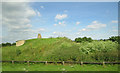
2
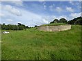
Mound outside Hilperton
This mound between Hilperton and Trowbridge has a wall inscribed Paxcroft Mead, the name of a nearby housing estate and community
Image: © David Smith
Taken: 9 Jun 2017
0.09 miles
3
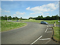
A361 sweeps around a roundabout
The roundabout is a junction with the B3051.
Image: © Stuart Logan
Taken: 17 Jun 2014
0.12 miles
4

Milestone, Hilperton Road, Trowbridge
Possibly not in its original position, as the road here has been re-engineered. It reads: 1864 Trowbridge 1 Devizes 9 Melksham 4
Image: © David Smith
Taken: 7 Jun 2017
0.12 miles
5
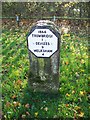
Milestone near Hilperton
For a wider view of the milestone Image
Image: © Maigheach-gheal
Taken: 17 Nov 2009
0.12 miles
6
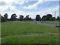
A361 roundabout from Paxcroft Mead mound
The view northwards from the mound Image]
Image: © David Smith
Taken: 9 Jun 2017
0.12 miles
7

Old Milestone by the A361, Hilperton Road, Trowbridge
Metal plate attached to stone post by the A361, in parish of TROWBRIDGE (WEST WILTSHIRE District), Hilperton Road; just West of junction with the B3105 roundabout, on deep verge, on South side of road. Erected by the Trowbridge turnpike trust in the 19th century.
Inscription reads:-
1864
TROWBRIDGE
1
DEVIZES
9
MELKSHAM
4
Carved benchmark and hole for rivet on top.
Milestone Society National ID: WI_DZTB09.
Image: © M Faherty
Taken: 2 Feb 2008
0.12 miles
8
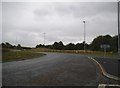
Roundabout on Hilperton Road, Trowbridge
Image: © David Howard
Taken: 21 Aug 2016
0.12 miles
9
![Trowbridge features [5]](https://s3.geograph.org.uk/geophotos/06/81/82/6818299_bbc9fc97_120x120.jpg)
Trowbridge features [5]
The milestone seen at Image in context.
A market town and county town of Wiltshire, Trowbridge lies on the River Biss, 6 miles (10 kilometres) south of Bath. The town developed as a centre for woollen cloth production from the 14th century, which from the 17th century became increasingly industrialized, so much so that, in 1820, Trowbridge was described as the "Manchester of the West" with over 20 woollen cloth producing factories. The Kennet and Avon Canal runs just to the north of the town and both the Wessex Main Line (Bristol–Westbury–Southampton) and the Heart of Wessex Line (Bristol–Westbury–Weymouth) railways serve the station.
Image: © Michael Dibb
Taken: 11 Apr 2021
0.12 miles
10
![Trowbridge features [4]](https://s2.geograph.org.uk/geophotos/06/81/82/6818298_2cd3abbb_120x120.jpg)
Trowbridge features [4]
Near the roundabout junction of the A361 and B3105 is this milestone. Possibly not in its original position as the roads hereabouts have been realigned. Erected by the Trowbridge turnpike trust in the 19th century. For a view of the milestone in context see Image
A market town and county town of Wiltshire, Trowbridge lies on the River Biss, 6 miles (10 kilometres) south of Bath. The town developed as a centre for woollen cloth production from the 14th century, which from the 17th century became increasingly industrialized, so much so that, in 1820, Trowbridge was described as the "Manchester of the West" with over 20 woollen cloth producing factories. The Kennet and Avon Canal runs just to the north of the town and both the Wessex Main Line (Bristol–Westbury–Southampton) and the Heart of Wessex Line (Bristol–Westbury–Weymouth) railways serve the station.
Image: © Michael Dibb
Taken: 11 Apr 2021
0.12 miles