
IMAGES TAKEN NEAR TO
Carisbrooke Crescent, TROWBRIDGE, BA14 7PA
Introduction
This page details the photographs taken nearby to Carisbrooke Crescent, BA14 7PA by members of the Geograph project.
The Geograph project started in 2005 with the aim of publishing, organising and preserving representative images for every square kilometre of Great Britain, Ireland and the Isle of Man.

There are currently over 7.5m images from over14,400 individuals and you can help contribute to the project by visiting https://www.geograph.org.uk
Image Map
Images are licensed for reuse under creativecommons.org/licenses/by-sa/2.0
Notes
- Clicking on the map will re-center to the selected point.
- The higher the marker number, the further away the image location is from the centre of the postcode.
Image Listing (62 Images Found)
Images are licensed for reuse under creativecommons.org/licenses/by-sa/2.0
Image
Details
Distance
1

2007 : Marsh Road Post Office, Hilperton Marsh
Combining the facilities of post office, shop, filling station and possibly second hand car sales.
Image: © Maurice Pullin
Taken: 23 Nov 2007
0.04 miles
2
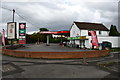
Texaco Garage
Off the roundabout of Marsh road, near Staverton.
Image: © Julian P Guffogg
Taken: 17 Aug 2019
0.06 miles
3
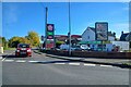
Trowbridge : Marsh Road
Marsh Road alongside the Texaco filling station.
Image: © Lewis Clarke
Taken: 18 Oct 2022
0.07 miles
4
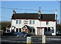
2007 : The Kings Arms, Hilperton Marsh
A few yards along the road from Image] the boater can find refreshment here, what more can he want?
Image: © Maurice Pullin
Taken: 23 Nov 2007
0.07 miles
5
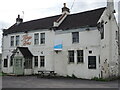
The Kings Arms - folded
A pub near the canal has closed in these testing times.
Image: © Neil Owen
Taken: 16 Aug 2021
0.08 miles
6

2007 : Marsh Road, Hilperton Marsh
View along Marsh Road toward Hilperton.
Image: © Maurice Pullin
Taken: 23 Nov 2007
0.09 miles
7

Hilperton Wharf Bridge, Kennet and Avon Canal
Seen from the west. The cottage or cottages were probably originally occupied by canal employees such as the wharfinger.
Image: © Dr Neil Clifton
Taken: 26 Mar 1977
0.11 miles
8
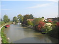
Kennet & Avon Canal, Hilperton
A view looking northeast along the Kennet & Avon canal, from the road overbridge at Hilperton.
Image: © Phil Williams
Taken: 16 Oct 2005
0.11 miles
9
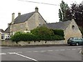
The Poplars, Trowbridge
A C19 house http://www.britishlistedbuildings.co.uk/en-314199-the-poplars-166-trowbridge and stable block http://www.britishlistedbuildings.co.uk/en-314200-stable-block-and-gate-piers-to-no-166-th now surrounded by a housing estate, seen across the junction of Saxon Drive and Wyke Road.
Image: © Derek Harper
Taken: 20 Jul 2011
0.11 miles
10
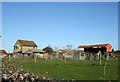
2007 : Maxcroft Farm, Hilperton Marsh
Within easy walking distance of pub, post office, general store, filling station and canal.
Image: © Maurice Pullin
Taken: 23 Nov 2007
0.11 miles