
IMAGES TAKEN NEAR TO
The Star, TROWBRIDGE, BA14 6QB
Introduction
This page details the photographs taken nearby to The Star, BA14 6QB by members of the Geograph project.
The Geograph project started in 2005 with the aim of publishing, organising and preserving representative images for every square kilometre of Great Britain, Ireland and the Isle of Man.

There are currently over 7.5m images from over14,400 individuals and you can help contribute to the project by visiting https://www.geograph.org.uk
Image Map
Images are licensed for reuse under creativecommons.org/licenses/by-sa/2.0
Notes
- Clicking on the map will re-center to the selected point.
- The higher the marker number, the further away the image location is from the centre of the postcode.
Image Listing (103 Images Found)
Images are licensed for reuse under creativecommons.org/licenses/by-sa/2.0
Image
Details
Distance
1

Boundary Wall by The Star
This boundary wall separates the road (The Star) from the substantial property which lies beyond the wall to the left of the image.
Image: © Doug Lee
Taken: 7 Jul 2013
0.07 miles
2
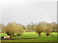
Meadow, Holt
The meadow is between the church and the River Avon.
Image: © Maigheach-gheal
Taken: 11 Nov 2010
0.08 miles
3
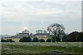
2007 : Avon View Farm
Seen across the fields from Station Road. The tall chimney does not ventilate the farm, it belongs to the factory at Staverton about a mile away.
Image: © Maurice Pullin
Taken: 16 Nov 2007
0.12 miles
4

Cattle, Holt
The meadow is waterlogged from recent rains and the cattle have poached the area around their hay feeder.
Image: © Maigheach-gheal
Taken: 11 Nov 2010
0.14 miles
5

Willows, Holt
The willow trees within the meadow and along the edge of a very small stream have in the past been pollarded. They have been allowed to grow and have formed some interesting shapes.
Image: © Maigheach-gheal
Taken: 11 Nov 2010
0.16 miles
6

Squeeze stile, Holt
The stile allows walkers to leave a meadow to take a path into the village and the B3107.
Image: © Maigheach-gheal
Taken: 11 Nov 2010
0.17 miles
7

Kissing gate, Holt
The kissing gate allows walkers to enter the meadow using the footpath to B3107.
The kissing gate is a traditional gate hung in a U or V shape that allows one person to pass at a time. In order for one person to pass fully through the gate they have to close it on the next person. Legend has it that at this point, when the two are on either side of the gate, the person in front ‘refuses’ entry to the second person until presented with a kiss.
Image: © Maigheach-gheal
Taken: 11 Nov 2010
0.17 miles

9

Old iron stile
An unusual type of stile near The Court, with a swing bar.
Image: © Neil Owen
Taken: 16 Aug 2021
0.18 miles
10

The land behind The Courts
Footpaths cross the open land at the southwest of Holt.
Image: © Neil Owen
Taken: 16 Aug 2021
0.18 miles