
IMAGES TAKEN NEAR TO
Keevil, TROWBRIDGE, BA14 6NE
Introduction
This page details the photographs taken nearby to BA14 6NE by members of the Geograph project.
The Geograph project started in 2005 with the aim of publishing, organising and preserving representative images for every square kilometre of Great Britain, Ireland and the Isle of Man.

There are currently over 7.5m images from over14,400 individuals and you can help contribute to the project by visiting https://www.geograph.org.uk
Image Map
Images are licensed for reuse under creativecommons.org/licenses/by-sa/2.0
Notes
- Clicking on the map will re-center to the selected point.
- The higher the marker number, the further away the image location is from the centre of the postcode.
Image Listing (42 Images Found)
Images are licensed for reuse under creativecommons.org/licenses/by-sa/2.0
Image
Details
Distance
1
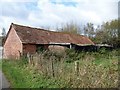
Farm outbuilding
Possibly part of Southview Farm. Seen from the minor road.
Image: © Michael Dibb
Taken: 5 Nov 2017
0.03 miles
2
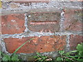
Ordnance Survey Cut Mark
This mark can be found on the wall of a barn in Main Street, Keevil.
For more details see : http://www.bench-marks.org.uk/bm41604
Image: © Peter Wood
Taken: 27 Feb 2012
0.03 miles
3
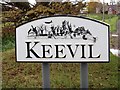
Village sign
An attractive sign at the entrance to the village.
Image: © Michael Dibb
Taken: 5 Nov 2017
0.05 miles
4
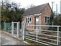
Pumping Station
Wessex Water pumping station in The Street.
Image: © Michael Dibb
Taken: 5 Nov 2017
0.07 miles

6
![Townmead Lane [4]](https://s2.geograph.org.uk/geophotos/05/60/88/5608814_b06f8823_120x120.jpg)
Townmead Lane [4]
The lane ends here where it meets the minor road.
Image: © Michael Dibb
Taken: 5 Nov 2017
0.08 miles
7
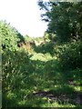
Byway near Keevil
The byway known as Towmead Lane takes you to Wick Bridge, it is also part of the White Horse Trail.
Image: © Maigheach-gheal
Taken: 27 Jul 2009
0.10 miles
8
![Keevil houses [9]](https://s2.geograph.org.uk/geophotos/05/60/88/5608830_150ab648_120x120.jpg)
Keevil houses [9]
Wisteria Cottage, number 91 Main Street, was built circa 1700 and is listed, grade II, with details at: https://www.historicengland.org.uk/listing/the-list/list-entry/1262662
Image: © Michael Dibb
Taken: 5 Nov 2017
0.12 miles
9
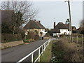
2009 : East on Main Street, Keevil
The one and only "for sale" sign seen in the village on this occasion, suggesting most of the inhabitants are happy where they are.
Heading for Bulkington about a mile and a half away.
Image: © Maurice Pullin
Taken: 1 Dec 2009
0.13 miles
10
![Keevil houses [10]](https://s1.geograph.org.uk/geophotos/05/60/88/5608833_30ffccfe_120x120.jpg)
Keevil houses [10]
Edgecombe Cottage, number 80, Main Street, one of a pair of semi-detached, is early 18th century and is listed, grade II, with details at: https://www.historicengland.org.uk/listing/the-list/list-entry/1251462 Number 79 is seen at Image
Image: © Michael Dibb
Taken: 5 Nov 2017
0.14 miles