IMAGES TAKEN NEAR TO
Common Hill, TROWBRIDGE, BA14 6ED

Introduction

This page details the photographs taken nearby to Common Hill, BA14 6ED by members of the Geograph project.

The Geograph project started in 2005 with the aim of publishing, organising and preserving representative images for every square kilometre of Great Britain, Ireland and the Isle of Man.

There are currently over 7.5m images from over14,400 individuals and you can help contribute to the project by visiting https://www.geograph.org.uk

Image Map


Images are licensed for reuse under creativecommons.org/licenses/by-sa/2.0
Notes
  • Clicking on the map will re-center to the selected point.
  • The higher the marker number, the further away the image location is from the centre of the postcode.

Image Listing (6 Images Found)

Images are licensed for reuse under creativecommons.org/licenses/by-sa/2.0
Image
Details
Distance
1
Abandoned petrol station, Steeple Ashton
On the corner of Hinton Lane and Common Hill, Steeple Ashton lies this abandoned petrol station complete with the final tally of served gallons of fuel on each pump.
Image: © Philip Reed Taken: 6 Mar 2008
0.03 miles
2
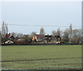
2009 : Over a frosty field to Steeple Ashton
The backs of houses at the north end of the village. Seen from Hinton Lane.
Image: © Maurice Pullin Taken: 1 Dec 2009
0.08 miles
3
2009 : A bicycle ridden along Hinton Lane
Toward Steeple Ashton. Good day for a ride, a touch of frost but not too cold, not much wind about.
Image: © Maurice Pullin Taken: 1 Dec 2009
0.15 miles
4
Footpath by the field boundary
To the right of this fence is pasture in which, at the time of taking the image, cows were grazing. On this side of the fence a footpath runs parallel to the fence. The field on this side appears to be planted with oil seed rape but in reality it seems to be primarily be growing thistles.
Image: © Doug Lee Taken: 22 Jul 2013
0.15 miles
5
Butts Lane, Steeple Ashton
An old lane in the middle of the village.
Image: © William Metcalfe Taken: 22 Sep 2007
0.21 miles
6
2009 : Straw bales blocking a gateway
Seen on Hinton Lane. Making an effective barrier but the fact that they are wrapped in plastic mesh suggests they will be of little further use.
Image: © Maurice Pullin Taken: 1 Dec 2009
0.24 miles