
IMAGES TAKEN NEAR TO
Victoria Bridge Road, BATH, BA1 3EZ
Introduction
This page details the photographs taken nearby to Victoria Bridge Road, BA1 3EZ by members of the Geograph project.
The Geograph project started in 2005 with the aim of publishing, organising and preserving representative images for every square kilometre of Great Britain, Ireland and the Isle of Man.

There are currently over 7.5m images from over14,400 individuals and you can help contribute to the project by visiting https://www.geograph.org.uk
Image Map
Images are licensed for reuse under creativecommons.org/licenses/by-sa/2.0
Notes
- Clicking on the map will re-center to the selected point.
- The higher the marker number, the further away the image location is from the centre of the postcode.
Image Listing (305 Images Found)
Images are licensed for reuse under creativecommons.org/licenses/by-sa/2.0
Image
Details
Distance
2
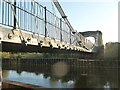
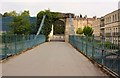
Bath : Victorian Bridge over the River Avon
The Victorian bridge over the River Avon
Image: © Lewis Clarke
Taken: 22 Oct 2008
0.02 miles
3
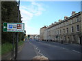
View along Upper Bristol Road towards the city centre #2
Looking south-southeast.
Image: © Robert Lamb
Taken: 15 Apr 2012
0.03 miles
4
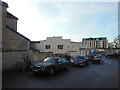
Former drill hall, Upper Bristol Rd
This was the WWI drill hall for the Wessex Divisional Royal Engineers (HQ & 1 Field Company) and 2nd South Western Mounted Brigade Field Ambulance RAMC (A Section). It still appears to be in use as an industrial building, on the site of Food Machinery Ltd.
Image: © HelenK
Taken: 7 Oct 2014
0.03 miles
5
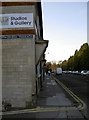
Onega Terrace
One of several little sideroads and alleyways that line the Upper Bristol Road. A cut benchmark has been installed on the corner of the buildings facing into the terrace. See Image] for a closer inspection.
Image: © Neil Owen
Taken: 16 Jan 2012
0.03 miles
6
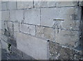
Spalled benchmark
This particular cut mark has suffered over the years since it was made. See Image] for a contextual view and http://www.bench-marks.org.uk/bm41417 for the listing in the Benchmark Database.
Image: © Neil Owen
Taken: 16 Jan 2012
0.03 miles
7
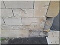
Ordnance Survey Cut Mark
This OS cut mark can be found on No1 Comfortable Place. It marks a point 22.221m above mean sea level.
Image: © Adrian Dust
Taken: 3 Dec 2022
0.03 miles
8
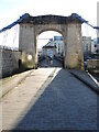
Approaching Victoria Bridge
One of Bath's significant structures as far as engineering is concerned, Victoria Bridge was built in 1836. It is an early form of suspension bridge design, although some refer to the cable-stayed elements as equally important. See Image] for a plaque regarding the leading creators.
Image: © Neil Owen
Taken: 20 Jan 2023
0.03 miles
10
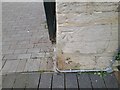
Ordnance Survey Cut Mark
This OS cut mark can be found on the north end of Victoria Bridge. It marks a point 20.545m above mean sea level.
Image: © Adrian Dust
Taken: 3 Dec 2022
0.04 miles