
IMAGES TAKEN NEAR TO
Southcroft, WESTBURY, BA13 4AU
Introduction
This page details the photographs taken nearby to Southcroft, BA13 4AU by members of the Geograph project.
The Geograph project started in 2005 with the aim of publishing, organising and preserving representative images for every square kilometre of Great Britain, Ireland and the Isle of Man.

There are currently over 7.5m images from over14,400 individuals and you can help contribute to the project by visiting https://www.geograph.org.uk
Image Map
Images are licensed for reuse under creativecommons.org/licenses/by-sa/2.0
Notes
- Clicking on the map will re-center to the selected point.
- The higher the marker number, the further away the image location is from the centre of the postcode.
Image Listing (29 Images Found)
Images are licensed for reuse under creativecommons.org/licenses/by-sa/2.0
Image
Details
Distance
1
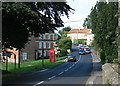
2008 : Junction with the road to Corsley
The name Chapmanslade has referred to the village since the 14th century at least, and is believed to mean that travelling merchants lived there. The principal local industries were weaving and agriculture, but the employment profile of the village is now very similar to Southern England generally. The present parish was established in the 1890s.
The above was copied from: http://en.wikipedia.org/wiki/Chapmanslade
Image: © Maurice Pullin
Taken: 1 Sep 2008
0.07 miles
2
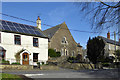
Former chapel, Chapmanslade
The old Congregational Chapel appears to have had a residential conversion.
Image: © Robin Webster
Taken: 2 Mar 2017
0.08 miles
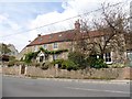
4
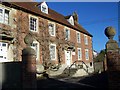
No 63 and 65 High Street, Chapmanslade
Grade II listed building. Number 63 was formerly the Wheelwrights Arms Inn.
Image: © Maigheach-gheal
Taken: 18 Jan 2009
0.10 miles
5
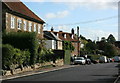
2008 : High Street, Chapmanslade
The A3098 links Frome with Westbury but adds nothing to Chapmanslade.
Image: © Maurice Pullin
Taken: 1 Sep 2008
0.10 miles
6
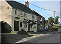
2008 : The Three Horseshoes, Chapmanslade
Enough horseshoes in Wiltshire for a cavalry regiment.
They have a website but it is not up to much. Good beer though.
Image: © Maurice Pullin
Taken: 1 Sep 2008
0.12 miles
7
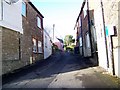
Wood Lane, Chapmanslade
A no through road leading from the main road.
Image: © Maigheach-gheal
Taken: 18 Jan 2009
0.13 miles
8
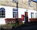
George VI postbox, Chapmanslade
Found in the wall of No 85 the High Street.
Image: © Maigheach-gheal
Taken: 18 Jan 2009
0.13 miles
9

2010 : George VI postbox in Chapmanslade
A closer view of the box seen in Image]
Image: © Maurice Pullin
Taken: 8 Mar 2010
0.13 miles
10
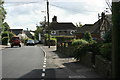
2008 : High Street, Chapmanslade (2)
With another view of The Three Horseshoes.
Image: © Maurice Pullin
Taken: 1 Sep 2008
0.14 miles