
IMAGES TAKEN NEAR TO
Giles Hollow, WARMINSTER, BA12 9QY
Introduction
This page details the photographs taken nearby to Giles Hollow, BA12 9QY by members of the Geograph project.
The Geograph project started in 2005 with the aim of publishing, organising and preserving representative images for every square kilometre of Great Britain, Ireland and the Isle of Man.

There are currently over 7.5m images from over14,400 individuals and you can help contribute to the project by visiting https://www.geograph.org.uk
Image Map
Images are licensed for reuse under creativecommons.org/licenses/by-sa/2.0
Notes
- Clicking on the map will re-center to the selected point.
- The higher the marker number, the further away the image location is from the centre of the postcode.
Image Listing (72 Images Found)
Images are licensed for reuse under creativecommons.org/licenses/by-sa/2.0
Image
Details
Distance
1
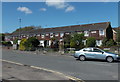
Foreminster Court, Warminster
Row of houses on the north side of Fore Street, viewed from the corner of Deverill Road.
Image: © Jaggery
Taken: 9 May 2014
0.03 miles
2
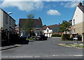
Giles Hollow, Warminster
Cul-de-sac on the west side of Deverill Road.
Image: © Jaggery
Taken: 9 May 2014
0.03 miles
3
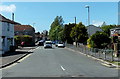
Fore Street, Warminster
Looking west from Deverill Road.
Image: © Jaggery
Taken: 9 May 2014
0.04 miles
4

Corner of Deverill Road and Fore Street, Warminster
Fore Street is on the right. There are no doors on the postbox side of the corner house and two former windows on the Deverill Road side have been replaced by bricks. This looks like a former shop, perhaps also a post office.
Image: © Jaggery
Taken: 9 May 2014
0.06 miles
5
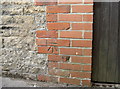
Benchmark in Deverill Road
See http://www.bench-marks.org.uk/bm52859 for the entry in the Benchmark Database or Image] for a wider location view.
Image: © Neil Owen
Taken: 27 Sep 2013
0.09 miles
6
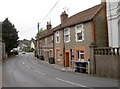
Deverill Road
A row of cottages, with the nearest possessing a benchmark - see Image
Image: © Neil Owen
Taken: 27 Sep 2013
0.09 miles
8
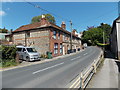
Pavement below road level, Deverill Road, Warminster
Railings line the right side of the road which is slightly above the pavement on this side.
Image: © Jaggery
Taken: 9 May 2014
0.09 miles
9

Chapel Street, Warminster
Viewed from the Deverill Road end looking towards Bread Street.
Image: © Jaggery
Taken: 9 May 2014
0.09 miles
10
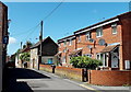
Satellite dishes in Chapel Street, Warminster
On the right, five dishes on the brick walls of houses
and one on a stone house wall behind a post, two more on the left.
Image: © Jaggery
Taken: 9 May 2014
0.09 miles