
IMAGES TAKEN NEAR TO
Upper Marsh Road, WARMINSTER, BA12 9PJ
Introduction
This page details the photographs taken nearby to Upper Marsh Road, BA12 9PJ by members of the Geograph project.
The Geograph project started in 2005 with the aim of publishing, organising and preserving representative images for every square kilometre of Great Britain, Ireland and the Isle of Man.

There are currently over 7.5m images from over14,400 individuals and you can help contribute to the project by visiting https://www.geograph.org.uk
Image Map
Images are licensed for reuse under creativecommons.org/licenses/by-sa/2.0
Notes
- Clicking on the map will re-center to the selected point.
- The higher the marker number, the further away the image location is from the centre of the postcode.
Image Listing (106 Images Found)
Images are licensed for reuse under creativecommons.org/licenses/by-sa/2.0
Image
Details
Distance
1
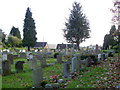
Churchyard, Christ Church, Warminster
The churchyard is large and very full. It is well tended.
Image: © Maigheach-gheal
Taken: 11 Nov 2010
0.01 miles
2

Upper Marsh Road, Warminster
The bungalow on the right is at the edge of Christ Church churchyard. http://www.geograph.org.uk/photo/4312438
Image: © Jaggery
Taken: 9 May 2014
0.02 miles
3
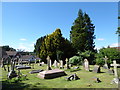
Christ Church, Warminster: churchyard (2)
Image: © Basher Eyre
Taken: 26 Aug 2016
0.04 miles
4
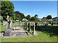
Christ Church, Warminster: churchyard (3)
Image: © Basher Eyre
Taken: 26 Aug 2016
0.04 miles
5
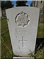
Christ Church, Warminster: churchyard (4)
Also see http://www.cwgc.org/find-war-dead/casualty/406853/GARRETT,%20WILLIAM
Image: © Basher Eyre
Taken: 26 Aug 2016
0.04 miles
6

Christ Church, Warminster: churchyard (5)
Also see http://www.cwgc.org/find-war-dead/casualty/406851/ADLAM,%20J
Image: © Basher Eyre
Taken: 26 Aug 2016
0.04 miles
7
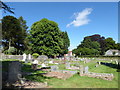
Christ Church, Warminster: churchyard (6)
Image: © Basher Eyre
Taken: 26 Aug 2016
0.04 miles
8
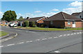
Glebe Field, Warminster
Cul-de-sac viewed across Upper Marsh Road from the edge of Christ Church.
A glebe field (or glebe) was land assigned as part of a parish clergyman’s living.
Image: © Jaggery
Taken: 9 May 2014
0.04 miles
9
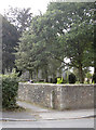
Path by Christ Church, Warminster
A little path leads around the church grounds towards Ebble Crescent. A benchmark can be found on the corner - see Image
Image: © Neil Owen
Taken: 27 Sep 2013
0.05 miles
10
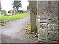
Benchmark by Christ Church graveyard
A cutmark, as listed in the Benchmark Database: http://www.bench-marks.org.uk/bm52861 , on the path that runs through the tombstones. See Image] for a wider view of the location.
Image: © Neil Owen
Taken: 27 Sep 2013
0.05 miles