
IMAGES TAKEN NEAR TO
Tennyson Close, WARMINSTER, BA12 8HL
Introduction
This page details the photographs taken nearby to Tennyson Close, BA12 8HL by members of the Geograph project.
The Geograph project started in 2005 with the aim of publishing, organising and preserving representative images for every square kilometre of Great Britain, Ireland and the Isle of Man.

There are currently over 7.5m images from over14,400 individuals and you can help contribute to the project by visiting https://www.geograph.org.uk
Image Map
Images are licensed for reuse under creativecommons.org/licenses/by-sa/2.0
Notes
- Clicking on the map will re-center to the selected point.
- The higher the marker number, the further away the image location is from the centre of the postcode.
Image Listing (17 Images Found)
Images are licensed for reuse under creativecommons.org/licenses/by-sa/2.0
Image
Details
Distance
1
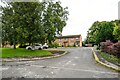
Warminster : Masefield Road
Looking along Masefield Road.
Image: © Lewis Clarke
Taken: 31 Jul 2023
0.05 miles
2
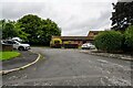
Warminster : Masefield Road
Looking along Masefield Road.
Image: © Lewis Clarke
Taken: 31 Jul 2023
0.06 miles
3

Warminster : Masefield Road Houses
Looking towards homes on Masefield Road.
Image: © Lewis Clarke
Taken: 31 Jul 2023
0.08 miles
4
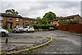
Warminster : Masefield Road Houses
Houses on Masefield Road.
Image: © Lewis Clarke
Taken: 31 Jul 2023
0.12 miles
5

Warminster : Masefield Road
Looking along Masefield Road.
Image: © Lewis Clarke
Taken: 31 Jul 2023
0.15 miles
6

Cottages in West Street
A row of old cottages and terraced houses to the west of the town centre. But in the past they were used as a drill hall for the Wiltshire Yeomanry. See http://www.geograph.org.uk/article/WW1-Great-War-Centenary---Drill-Halls/12#wiltshire for a look at the county's halls.
Image: © Neil Owen
Taken: 7 Oct 2014
0.18 miles
7
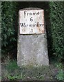
Old Milestone by Victoria Road, Bugley, Warminster parish
Metal plate attached to stone post by the UC road (was A362), in parish of WARMINSTER (WEST WILTSHIRE District), Victoria Road, Bugley; by No. 1 Saxons Acre, in cypress hedge niche, on South side of road. Frome iron plate, erected by the Frome turnpike trust in the 18th century.
Inscription reads:-
Frome
6
Warminfter
1
Milestone Society National ID: WI_WMFR01.
Image: © M Faherty
Taken: 10 Mar 2007
0.18 miles
8
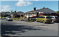
Thornhill Road bungalows in Warminster
Looking west from near a Tesco Express. http://www.geograph.org.uk/photo/4117716
Image: © Jaggery
Taken: 9 May 2014
0.19 miles
9
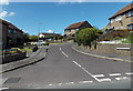
Middleton Close, Warminster
Viewed across Pound Street.
Image: © Jaggery
Taken: 9 May 2014
0.21 miles
10
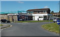
Tesco Express, Warminster
Located at 2 Thornhill Road in the west of Warminster. Usually located in a suburb, as here, a Tesco Express store has a very small selection of the range of items available in a Tesco Extra superstore.
Image: © Jaggery
Taken: 9 May 2014
0.21 miles