
IMAGES TAKEN NEAR TO
Deep Lane, WARMINSTER, BA12 7QQ
Introduction
This page details the photographs taken nearby to Deep Lane, BA12 7QQ by members of the Geograph project.
The Geograph project started in 2005 with the aim of publishing, organising and preserving representative images for every square kilometre of Great Britain, Ireland and the Isle of Man.

There are currently over 7.5m images from over14,400 individuals and you can help contribute to the project by visiting https://www.geograph.org.uk
Image Map
Images are licensed for reuse under creativecommons.org/licenses/by-sa/2.0
Notes
- Clicking on the map will re-center to the selected point.
- The higher the marker number, the further away the image location is from the centre of the postcode.
Image Listing (5 Images Found)
Images are licensed for reuse under creativecommons.org/licenses/by-sa/2.0
Image
Details
Distance
1

Deep Lane
A deeply sunken lane on the hill - it must be on sandstone. Presumably once the surface is protected with tarmac, the downwards drift of sand is arrested and the lane gets no deeper.
Image: © Robin Webster
Taken: 2 Mar 2017
0.10 miles
2
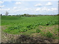
Farmland near Corsley
A view looking to the northwest over the farmland in a dry valley off Deep Lane. The tower of St. Margarets church can be seen just right of centre, with the buildings of Chapmanslade on the horizon.
Image: © Phil Williams
Taken: 7 May 2006
0.12 miles
3
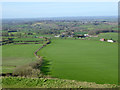
View north-west from Cley Hill
The nearest buildings in the centre are at Chipps Farm, with Corsley beyond and distantly Chapmanslade.
Image: © Robin Webster
Taken: 2 Mar 2017
0.18 miles
4

2010 : Meadow near Park Farm, off Deep Lane
Looking north toward Chapmanslade.
The meadow looks unused and uncared for, good for wildlife.
The valley between here and Chapmanslade contains the Rodden Brook flowing through Corsley.
Image: © Maurice Pullin
Taken: 28 Jun 2010
0.22 miles
5

2008 : Chipps Farm, the sign
Almost at the foot of Cley Hill.
Image: © Maurice Pullin
Taken: 1 Sep 2008
0.24 miles