
IMAGES TAKEN NEAR TO
Tytherington, WARMINSTER, BA12 7DX
Introduction
This page details the photographs taken nearby to BA12 7DX by members of the Geograph project.
The Geograph project started in 2005 with the aim of publishing, organising and preserving representative images for every square kilometre of Great Britain, Ireland and the Isle of Man.

There are currently over 7.5m images from over14,400 individuals and you can help contribute to the project by visiting https://www.geograph.org.uk
Image Map
Images are licensed for reuse under creativecommons.org/licenses/by-sa/2.0
Notes
- Clicking on the map will re-center to the selected point.
- The higher the marker number, the further away the image location is from the centre of the postcode.
Image Listing (54 Images Found)
Images are licensed for reuse under creativecommons.org/licenses/by-sa/2.0
Image
Details
Distance
2
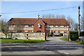
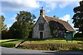
St. James Court, Tytherington
A conversion from farm buildings.
Image: © Robin Webster
Taken: 2 Mar 2017
0.01 miles
3
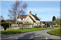
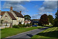
Late 18th century farmhouse, Tytherington
A grade II listed building.
Image: © Robin Webster
Taken: 2 Mar 2017
0.04 miles
4
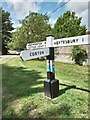
Direction Sign – Signpost in Tytherington
Located on the northwest side of a T junction in Tytherington, opposite St James church. Heytesbury parish. 3 arms and pyramid top finial. See https://www.geograph.org.uk/photo/6578194 for a photo before it was refurbished.
Milestone Society National ID: WI_ST9141
Image: © G Fawcett
Taken: 1 Jul 2023
0.04 miles
5
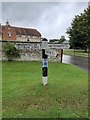
Direction Sign – Signpost in Tytherington
Located on the northwest side of a T junction in Tytherington, opposite St James church, in Heytesbury parish. 3 arms and pyramid top finial. See https://www.geograph.org.uk/photo/7537122 for a more recent photo.
Milestone Society National ID: WI_ST9141
Image: © Z La Gumina
Taken: 23 Aug 2020
0.04 miles
8
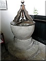
Font, The Church of St James
The font and cover date from the 17th century.
Image: © Maigheach-gheal
Taken: 16 Jun 2011
0.04 miles
9
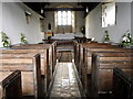
Interior, The Church of St James
The three light east window dates from the 19th century and the oak pews are from the 17th century.
Image: © Maigheach-gheal
Taken: 16 Jun 2011
0.04 miles
10
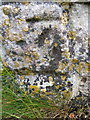
Bench Mark, The Church of St James
The Ordnance Survey bench mark is to be found on the west face of the church. For a wider view of the church http://www.geograph.org.uk/photo/332539 and for further information on the cut mark http://www.bench-marks.org.uk/bm38320
Image: © Maigheach-gheal
Taken: 16 Jun 2011
0.04 miles