1
Sand Hill Farm
Farming operation in Longbridge Deverill
Image: © Chris Heaton
Taken: 31 Jan 2022
0.06 miles
2
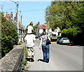
2010 : Cyclists in Longbridge Deverill
Heading east on the road to Sutton Veny.
"The village of Longbridge Deverill is part of the Deverill valley. This encompasses six villages on the Wiltshire Downs where the western edge of Salisbury Plain dips into Somerset. Longbridge is the principal village and its parish includes neighbouring Crockerton. The other Deverills are Hill, now in Longbridge parish, Brixton, Monkton and Kingston."
The above was copied from: http://www.wiltshire.gov.uk/community/getcom.php?id=143
Image: © Maurice Pullin
Taken: 22 May 2010
0.10 miles
3
Footpath leaving Longbridge Deverill
Leading south towards Hill Deverill
Image: © Tim Heaton
Taken: 31 Jan 2022
0.11 miles
4
Sand Street, Longbridge Deverill
Image: © Chris Heaton
Taken: 31 Jan 2022
0.11 miles
5
Footpath heading South from Sand Street, Longbridge Deverill
The footpath runs to the left of the boundary hedge - although it is marked as running on the right according to the map
Image: © Chris Heaton
Taken: 31 Jan 2022
0.12 miles
6
2010 : Row of cottages, Longbridge Deverill
On the road to Sutton Veny.
"The first evidence of organised villages is around 600 B.C. An Iron Age site is on Cow Down at Longbridge Deverill. The settlement on Cold Kitchen Hill was occupied until c350 B.C. Another Iron Age site is near Keysley Farm between Kingston Deverill and Pertwood."
The above was copied from: http://www.wiltshire.gov.uk/community/getcom.php?id=143
Image: © Maurice Pullin
Taken: 22 May 2010
0.12 miles
7
2010 : River Wylye downstream, Longbridge Deverill
From the bridge on Sand Street.
Image: © Maurice Pullin
Taken: 22 May 2010
0.13 miles
8
2010 : Walkers and rider, Sand Street, Longbridge Deverill
On the bridge over the River Wylye.
Image: © Maurice Pullin
Taken: 22 May 2010
0.13 miles
9
Plaque, Longbridge Deverill
The plaque is attached to the bridge over the River Wylye.
Image: © Maigheach-gheal
Taken: 19 Mar 2011
0.14 miles
10
River Wylye, Longbridge Deverill
Looking downstream from Longbridge Deverill Bridge.
Image: © Maigheach-gheal
Taken: 19 Mar 2011
0.14 miles


