
IMAGES TAKEN NEAR TO
North Road, WARMINSTER, BA12 6HP
Introduction
This page details the photographs taken nearby to North Road, BA12 6HP by members of the Geograph project.
The Geograph project started in 2005 with the aim of publishing, organising and preserving representative images for every square kilometre of Great Britain, Ireland and the Isle of Man.

There are currently over 7.5m images from over14,400 individuals and you can help contribute to the project by visiting https://www.geograph.org.uk
Image Map
Images are licensed for reuse under creativecommons.org/licenses/by-sa/2.0
Notes
- Clicking on the map will re-center to the selected point.
- The higher the marker number, the further away the image location is from the centre of the postcode.
Image Listing (113 Images Found)
Images are licensed for reuse under creativecommons.org/licenses/by-sa/2.0
Image
Details
Distance
1
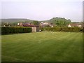
Mere Croquet Club
Formed to make use of open space off Steep Street and preserve it from development when the bowls club moved elsewhere, this small ground accommodates a clubhouse, toilet block and boules as well as croquet.
Image: © Patrick Mackie
Taken: 29 Apr 2011
0.01 miles
2
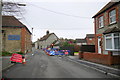
Temporary Traffic Lights Hazzards Hill
The temporary lights were to allow work to take place at the junction with New Cut (Upper Water Street). There is a culverted stream under the road at this point.
Image: © Nigel Mykura
Taken: 25 Feb 2015
0.11 miles
3

An old industry in Mere
These buildings were originally the town brewery, established in the 1800s. That business ended in 1900 and the site converted into a milk factory; later owners in the 1950s were Cow and Gate, later Unigate. Dairy production ended in the early 1970s, with a local firm of wine merchants taking over; they have only recently put the site on the market.
Image: © Neil Owen
Taken: 25 Feb 2025
0.11 miles
4

A date in the wall
Mere's old brewery buildings were opened in the 1800s, later converting to a milk factory and now potentially becoming a residential development. On the wall is a stone dated 1838.
Image: © Neil Owen
Taken: 25 Feb 2025
0.12 miles

7
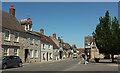
The Square and Salisbury Street, Mere
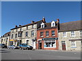
Many of the buildings on the left are listed: on the left, beside The Bower House, is Cross House, with a "prominent C19 hipped slate dormer with glazed cheeks ... The whole appears to have been some form of workship {sic} or commercial activity attached to the house front" https://www.historicengland.org.uk/listing/the-list/list-entry/1130729 . Next is the rendered Crossways https://www.historicengland.org.uk/listing/the-list/list-entry/1300855 , followed by Blue Rider https://www.historicengland.org.uk/listing/the-list/list-entry/1130730 with a "steep, long roof slope" and, behind the lamppost and belisha beacon, Georgian House https://www.historicengland.org.uk/listing/the-list/list-entry/1200260 . Salisbury Street is the B3095, formerly the A303 when the main road came through the town centre.
Image: © Derek Harper
Taken: 29 Jun 2018
0.13 miles
8

Mere Fire Station
A view looking the west towards the fire station at Mere.
Image: © Phil Williams
Taken: 1 Jul 2007
0.14 miles
9

Fire Station at Mere
A view looking to the northwest towards the fire station. The Mere police station is co-located at these premises, the entrance just visible at left at the top of the ramp by the yellow railings.
Image: © Phil Williams
Taken: 1 Jul 2007
0.14 miles
10
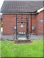
Fire bell at Mere
A view of the fire bell outside the fire station at Mere.
Image: © Phil Williams
Taken: 1 Jul 2007
0.14 miles