IMAGES TAKEN NEAR TO
Castle Hill Crescent, WARMINSTER, BA12 6HL

Introduction

This page details the photographs taken nearby to Castle Hill Crescent, BA12 6HL by members of the Geograph project.

The Geograph project started in 2005 with the aim of publishing, organising and preserving representative images for every square kilometre of Great Britain, Ireland and the Isle of Man.

There are currently over 7.5m images from over14,400 individuals and you can help contribute to the project by visiting https://www.geograph.org.uk

Image Map


Images are licensed for reuse under creativecommons.org/licenses/by-sa/2.0
Notes
  • Clicking on the map will re-center to the selected point.
  • The higher the marker number, the further away the image location is from the centre of the postcode.

Image Listing (230 Images Found)

Images are licensed for reuse under creativecommons.org/licenses/by-sa/2.0
  • ...
Image
Details
Distance
1
View east from Castle Hill
Image: © David Martin Taken: 14 Sep 2018
0.06 miles
2
Old Ship Inn Sign
Magnificent wrought iron inn sign overhanging Castle Street, Mere. This was a coaching inn on the London-Exeter road. http://merewilts.org/
Image: © Colin Smith Taken: 21 Apr 2012
0.08 miles
3
Old Ship Inn
Fine old coaching inn on Castle Street, Mere. This was once on the London-Exeter coach road. http://merewilts.org/
Image: © Colin Smith Taken: 21 Apr 2012
0.08 miles
4
Old Ship Inn, Castle Street
Former coaching inn in the centre of Mere. This was on the London-Exeter coaching route. http://merewilts.org/
Image: © Colin Smith Taken: 21 Apr 2012
0.08 miles
5
The Old Ship Inn, Mere
Image: © PAUL FARMER Taken: 19 Mar 2016
0.08 miles
6
The George Inn, Mere
The building dates from the late 16th or early 17th century. It stands on the market square. For a view of the sign Image
Image: © Maigheach-gheal Taken: 31 Jan 2011
0.08 miles
7
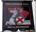
Sign for the George Inn
This sign for the inn replaces Image
Image: © Maigheach-gheal Taken: 31 Jan 2011
0.08 miles
8
Castle Street, Mere
Looking right from where Image] was taken, along the B3095. Next to Midwinter House is the listed Manderley https://www.historicengland.org.uk/listing/the-list/list-entry/1199898 with a display window. Next is the Butt of Sherry inn https://www.historicengland.org.uk/listing/the-list/list-entry/1130749 , with mansard roof.
Image: © Derek Harper Taken: 29 Jun 2018
0.09 miles
9
Castle Street
This would once have been the main road leading westwards out of the village of Mere, away from The Square. Now the village is by-passed by the modern A303. http://merewilts.org/
Image: © Colin Smith Taken: 21 Apr 2012
0.09 miles
10
Castle Street, Mere
The B3095 approaches the town centre. At the bend are the Ship Inn and the former bank, now for sale.
Image: © Derek Harper Taken: 29 Jun 2018
0.09 miles
  • ...