
IMAGES TAKEN NEAR TO
Ivy Mead, WARMINSTER, BA12 6EN
Introduction
This page details the photographs taken nearby to Ivy Mead, BA12 6EN by members of the Geograph project.
The Geograph project started in 2005 with the aim of publishing, organising and preserving representative images for every square kilometre of Great Britain, Ireland and the Isle of Man.

There are currently over 7.5m images from over14,400 individuals and you can help contribute to the project by visiting https://www.geograph.org.uk
Image Map
Images are licensed for reuse under creativecommons.org/licenses/by-sa/2.0
Notes
- Clicking on the map will re-center to the selected point.
- The higher the marker number, the further away the image location is from the centre of the postcode.
Image Listing (33 Images Found)
Images are licensed for reuse under creativecommons.org/licenses/by-sa/2.0
Image
Details
Distance

2

A date in the wall
Mere's old brewery buildings were opened in the 1800s, later converting to a milk factory and now potentially becoming a residential development. On the wall is a stone dated 1838.
Image: © Neil Owen
Taken: 25 Feb 2025
0.11 miles
3

An old industry in Mere
These buildings were originally the town brewery, established in the 1800s. That business ended in 1900 and the site converted into a milk factory; later owners in the 1950s were Cow and Gate, later Unigate. Dairy production ended in the early 1970s, with a local firm of wine merchants taking over; they have only recently put the site on the market.
Image: © Neil Owen
Taken: 25 Feb 2025
0.11 miles

6
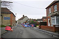
Temporary Traffic Lights Hazzards Hill
The temporary lights were to allow work to take place at the junction with New Cut (Upper Water Street). There is a culverted stream under the road at this point.
Image: © Nigel Mykura
Taken: 25 Feb 2015
0.12 miles
7
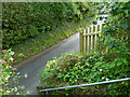
The Orange Way in Wiltshire (29)
These are steps down from an elevated path in front of houses to the road at The Lynch.
Image: © Shazz
Taken: 26 Sep 2012
0.12 miles
8
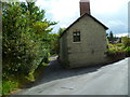
The Orange Way in Wiltshire (30)
The walk goes down the tiny lane to the left.
Image: © Shazz
Taken: 26 Sep 2012
0.15 miles

10
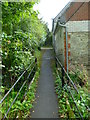
The Orange Way in Wiltshire (31)
The lane at the end of the path is Mill Lane.
Image: © Shazz
Taken: 26 Sep 2012
0.17 miles