
IMAGES TAKEN NEAR TO
Chetcombe Road, WARMINSTER, BA12 6AZ
Introduction
This page details the photographs taken nearby to Chetcombe Road, BA12 6AZ by members of the Geograph project.
The Geograph project started in 2005 with the aim of publishing, organising and preserving representative images for every square kilometre of Great Britain, Ireland and the Isle of Man.

There are currently over 7.5m images from over14,400 individuals and you can help contribute to the project by visiting https://www.geograph.org.uk
Image Map
Images are licensed for reuse under creativecommons.org/licenses/by-sa/2.0
Notes
- Clicking on the map will re-center to the selected point.
- The higher the marker number, the further away the image location is from the centre of the postcode.
Image Listing (20 Images Found)
Images are licensed for reuse under creativecommons.org/licenses/by-sa/2.0
Image
Details
Distance
2
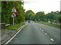
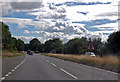
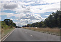
Mere : A303
Looking along the A303 past Mere.
Image: © Lewis Clarke
Taken: 12 Sep 2020
0.06 miles
3

The Beeches Chetcombe Rd
This is a large house built of blue lias stone with hamstone mullions and lintels. In front of it is the old A303. The new A303 dual carriageway is behind the house and it removed a large part of the garden of this house when it was built.
Image: © Nigel Mykura
Taken: 27 Jul 2014
0.06 miles
5
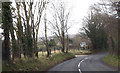
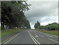
Running into Mere on B3095
Junction for A303 signposted ahead
Image: © John Firth
Taken: 11 Apr 2013
0.08 miles
8

Mere Fire Station
Mere Fire Station, White Road, Mere, Wiltshire
Image: © Kevin Hale
Taken: 6 May 2007
0.14 miles
10
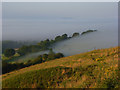
Downland, Mere
The view from the ridge just above the B3095, which is in the trees to the left, over the misty countryside around the Wilts / Dorset boundary.
Image: © Andrew Smith
Taken: 27 Jul 2008
0.18 miles