
IMAGES TAKEN NEAR TO
Mere, WARMINSTER, BA12 6AT
Introduction
This page details the photographs taken nearby to BA12 6AT by members of the Geograph project.
The Geograph project started in 2005 with the aim of publishing, organising and preserving representative images for every square kilometre of Great Britain, Ireland and the Isle of Man.

There are currently over 7.5m images from over14,400 individuals and you can help contribute to the project by visiting https://www.geograph.org.uk
Image Map
Images are licensed for reuse under creativecommons.org/licenses/by-sa/2.0
Notes
- Clicking on the map will re-center to the selected point.
- The higher the marker number, the further away the image location is from the centre of the postcode.
Image Listing (7 Images Found)
Images are licensed for reuse under creativecommons.org/licenses/by-sa/2.0
Image
Details
Distance
1
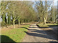
Track to Mere Down Farm
Looking eastward.
Image: © Peter Wood
Taken: 13 Feb 2017
0.03 miles
2

Track from Mere Down Farm at its junction with the B3095
Looking westward.
Image: © Peter Wood
Taken: 13 Feb 2017
0.06 miles
3
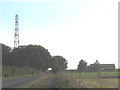
Mere Down
The communications mast adjacent to the B3095 at Mere Down.
Image: © Phil Williams
Taken: 9 Sep 2005
0.11 miles
4
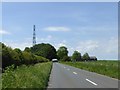
Telephone mast, Mere Down
In a patch of woodland, by B3095, near Mere Down Farm
Image: © David Smith
Taken: 1 Jun 2017
0.15 miles
5
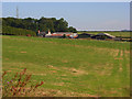
Mere Down Farm
Viewed from the byway to the south. The mast stands beside the B3095.
Image: © Andrew Smith
Taken: 27 Jul 2008
0.15 miles
6
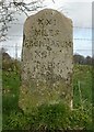
Old Milestone by the track on Mere Down, north of Mere
Carved stone post by the UC road, in parish of MERE (SALISBURY District), Mere Down; 500m East of large house and junction with B3095, against fence, on North side of track. Wilton Ox-drove stone, erected by an unknown authority in the 18th century.
Inscription reads:-
XXI
MILES
FROM SARUM
XCIX
FROM
LONDON
1750
Grade II listed. List Entry Number: 1300867
https://historicengland.org.uk/listing/the-list/list-entry/1300867
Milestone Society National ID: WI_SAOD21.
Image: © M Faherty
Taken: 25 Feb 2007
0.19 miles
7
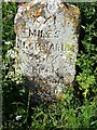
Old Milestone by the track on Mere Down, north of Mere
Carved stone post by the UC road, in parish of MERE (SALISBURY District), Mere Down; 500m East of large house and junction with B3095, against fence, on North side of track. Wilton Ox-drove stone, erected by an unknown authority in the 18th century.
Inscription reads:-
XXI
MILES
FROM SARUM
XCIX
FROM
LONDON
1750
Grade II listed. List Entry Number: 1300867
https://historicengland.org.uk/listing/the-list/list-entry/1300867
Milestone Society National ID: WI_SAOD21.
Image: © Katherine Grugeon
Taken: 20 May 2020
0.19 miles