
IMAGES TAKEN NEAR TO
West Knoyle, WARMINSTER, BA12 6AJ
Introduction
This page details the photographs taken nearby to BA12 6AJ by members of the Geograph project.
The Geograph project started in 2005 with the aim of publishing, organising and preserving representative images for every square kilometre of Great Britain, Ireland and the Isle of Man.

There are currently over 7.5m images from over14,400 individuals and you can help contribute to the project by visiting https://www.geograph.org.uk
Image Map
Images are licensed for reuse under creativecommons.org/licenses/by-sa/2.0
Notes
- Clicking on the map will re-center to the selected point.
- The higher the marker number, the further away the image location is from the centre of the postcode.
Image Listing (9 Images Found)
Images are licensed for reuse under creativecommons.org/licenses/by-sa/2.0
Image
Details
Distance
1
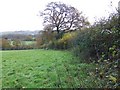
Footpath near Charnage
The footpath follows the hedge.
Image: © Maigheach-gheal
Taken: 16 Nov 2009
0.11 miles
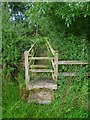
3
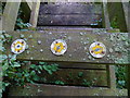
The Orange Way in Wiltshire (39)
These waymarks are on the footbridge. The Orange Way continues to follow the Monarch's Way.
Image: © Shazz
Taken: 26 Sep 2012
0.13 miles
4
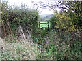
Footpath near Charnage
The stile is reached via a narrow plank bridge.
Image: © Maigheach-gheal
Taken: 16 Nov 2009
0.15 miles
5
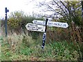
Signs near Charnage
The road sign is a little wonky, but the footpath sign stands true and straight.
Image: © Maigheach-gheal
Taken: 16 Nov 2009
0.15 miles
6
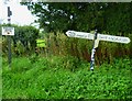
The Orange Way in Wiltshire (37)
The route crosses Six Acre Lane and enters a field.
Image: © Shazz
Taken: 26 Sep 2012
0.15 miles
7
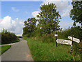
Road, West Knoyle
The junction south of The Middles. East Knoyle is signposted towards the camera, Mere and West Knoyle away from camera. You could just as easily go left in order to reach Mere. Arguably towards the camera is the quicker route to the greater part of West Knoyle.
Image: © Andrew Smith
Taken: 13 Sep 2008
0.16 miles
8
Lane to Charnage
No apparent name, but not needed for address reasons as there are no premises on it.
Image: © Robin Webster
Taken: 2 Apr 2017
0.20 miles
9
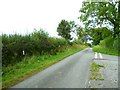
The Orange Way in Wiltshire (36)
The lane on the right is Barrow Street Lane. The signpost on the left is derelict.
Image: © Shazz
Taken: 26 Sep 2012
0.23 miles