
IMAGES TAKEN NEAR TO
Bapton, WARMINSTER, BA12 0SB
Introduction
This page details the photographs taken nearby to BA12 0SB by members of the Geograph project.
The Geograph project started in 2005 with the aim of publishing, organising and preserving representative images for every square kilometre of Great Britain, Ireland and the Isle of Man.

There are currently over 7.5m images from over14,400 individuals and you can help contribute to the project by visiting https://www.geograph.org.uk
Image Map
Images are licensed for reuse under creativecommons.org/licenses/by-sa/2.0
Notes
- Clicking on the map will re-center to the selected point.
- The higher the marker number, the further away the image location is from the centre of the postcode.
Image Listing (8 Images Found)
Images are licensed for reuse under creativecommons.org/licenses/by-sa/2.0
Image
Details
Distance
1

Bapton Manor
This country house has its origins in the C17, but was rebuilt in the mid C18, and extended in both the C19 and C20. Grade II Listed.
Image: © Mike Searle
Taken: 11 Feb 2008
0.08 miles
2

Postbox near Bapton
Victorian postbox fitted into the wall of Bryants Cottage.
Image: © Maigheach-gheal
Taken: 28 Jun 2009
0.14 miles
3
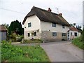
Bryants Cottage near Bapton
A thatched cottage with a Victorian postbox in the wall. Image
Image: © Maigheach-gheal
Taken: 28 Jun 2009
0.14 miles
4
Road from Wylye towards Bapton and Stockton
Image: © Robin Webster
Taken: 2 Mar 2017
0.15 miles
5

Cattle, Bapton
The heifer watched me for some time as I walked my dog along the bridleway.
Image: © Maigheach-gheal
Taken: 28 Jun 2009
0.15 miles
6
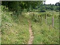
Bridleway near Bapton
The bridleway takes walkers and riders across water meadows to Fisherton de la Mere.
Image: © Maigheach-gheal
Taken: 28 Jun 2009
0.17 miles
7

Bridleway near Bapton
The bridleway takes walkers and riders across the railway line towards the A303.
Image: © Maigheach-gheal
Taken: 28 Jun 2009
0.18 miles
8
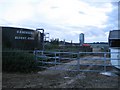
Slurry store and farm near Bapton
A unnamed farm lies at the end of a short tarmaced private road off the C road that runs through Bapton. There are fields of cows, a hay barn, various farm buildings, but no farmhouse, and this slurry store. For the technically minded, Gascoigne is the name of the Belgian manufacturer, and these stores can have capacities of 200,000 gallons upwards, and come with agitation systems. The farm road ends at the bridge over the railway between Salisbury and Warminster and there are no rights of way beyond.
Image: © Andy Gryce
Taken: 15 Jun 2007
0.21 miles