
IMAGES TAKEN NEAR TO
New Road, WARMINSTER, BA12 0NS
Introduction
This page details the photographs taken nearby to New Road, BA12 0NS by members of the Geograph project.
The Geograph project started in 2005 with the aim of publishing, organising and preserving representative images for every square kilometre of Great Britain, Ireland and the Isle of Man.

There are currently over 7.5m images from over14,400 individuals and you can help contribute to the project by visiting https://www.geograph.org.uk
Image Map
Images are licensed for reuse under creativecommons.org/licenses/by-sa/2.0
Notes
- Clicking on the map will re-center to the selected point.
- The higher the marker number, the further away the image location is from the centre of the postcode.
Image Listing (91 Images Found)
Images are licensed for reuse under creativecommons.org/licenses/by-sa/2.0
Image
Details
Distance
1
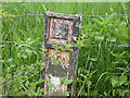
Old Boundary Marker by the former A36, High Street, Codford
Parish Boundary Marker by the UC (was A36), in parish of Codford (West Wiltshire District), High Street, at junction with New Road, opposite petrol station on verge against barbed wire fence.
Lost.
Grade II Listed. List Entry Number: 1181209
https://historicengland.org.uk/listing/the-list/list-entry/1181209
Milestone Society National ID: WI_SAWM14pb
Image: © Milestone Society
Taken: 22 May 2008
0.10 miles
2

Modern rural housing, Codford St Peter
Hopefully weather and vegetation will mellow them with the passing of time...
Image: © David Martin
Taken: 22 Apr 2012
0.11 miles
3
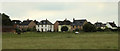
2011 : Houses on Green Lane, Codford St. Mary
Seen from New Road.
Image: © Maurice Pullin
Taken: 4 Jun 2011
0.16 miles
4
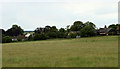
2011 : More houses on Green Lane, Codford
Seen across a hayfield from New Road.
Image: © Maurice Pullin
Taken: 4 Jun 2011
0.17 miles
5

Old Milestone by the former A36, High Street, Codford
Carved stone post by the UC road (was A36), in parish of Codford (West Wiltshire District), High Street; Codford; next to footpath, against perimeter wall of Overton House, on North side of road. Old Warminster stone, erected by the Fisherton, Wilton, Heytesbury, Willoughby Hedge & Redhone Turnpike Trust in the 18th century. The stone was rescued in pieces by members of the Milestone Society, and re-erected by Codford Local History Society.
Inscription reads:-
To
SARUM
XIV
To
Warmi(nster)
VI
1766
Milestone Society National ID: WI_SAWM14A.
Image: © Milestone Society
Taken: 8 Oct 2017
0.20 miles
6

Gargoyle, St Peter's Church, Codford St Peter
The tower gargoyles are 15th century.
Image: © Maigheach-gheal
Taken: 3 Sep 2008
0.21 miles
7
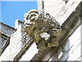
Gargoyle, St Peter's Church, Codford St Peter
The tower gargoyles are 15th century.
Image: © Maigheach-gheal
Taken: 3 Sep 2008
0.21 miles
8

Boss, St Peter's Church, Codford St Peter
This is the ceiling boss in the porch.
Image: © Maigheach-gheal
Taken: 3 Sep 2008
0.21 miles
9
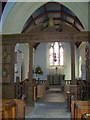
Interior, St Peter's Church, Codford St Peter
The screen was designed by F C Eden.
Image: © Maigheach-gheal
Taken: 3 Sep 2008
0.21 miles
10
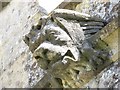
Gargoyle, St Peter's Church, Codford St Peter
The tower gargolyes are 15th century.
Image: © Maigheach-gheal
Taken: 3 Sep 2008
0.21 miles