
IMAGES TAKEN NEAR TO
High Meadow, WARMINSTER, BA12 0AJ
Introduction
This page details the photographs taken nearby to High Meadow, BA12 0AJ by members of the Geograph project.
The Geograph project started in 2005 with the aim of publishing, organising and preserving representative images for every square kilometre of Great Britain, Ireland and the Isle of Man.

There are currently over 7.5m images from over14,400 individuals and you can help contribute to the project by visiting https://www.geograph.org.uk
Image Map
Images are licensed for reuse under creativecommons.org/licenses/by-sa/2.0
Notes
- Clicking on the map will re-center to the selected point.
- The higher the marker number, the further away the image location is from the centre of the postcode.
Image Listing (35 Images Found)
Images are licensed for reuse under creativecommons.org/licenses/by-sa/2.0
Image
Details
Distance
2
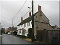
Houses at Upton Scudamore
Looking west
Image: © M J Richardson
Taken: 24 Dec 2015
0.08 miles
3
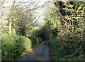
2008 : Down to the bottom
Biss Bottom to be precise. The source of the River Biss.
Image: © Maurice Pullin
Taken: 19 Nov 2008
0.12 miles

7
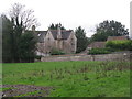
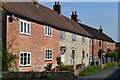
The Old Rectory at Upton Scudamore
Looking across from Manor Farm.
Image: © M J Richardson
Taken: 24 Dec 2015
0.19 miles

9
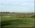
2008 : North west from the lane to Biss Bottom
Biss Bottom drops away on the far side of the field.
We are looking toward Hisomley and Dilton Marsh, bits of which can be seen.
Image: © Maurice Pullin
Taken: 19 Nov 2008
0.20 miles
10

2008 : Toward Biss Bottom near Upton Scudamore
Taken from the lane leading to Biss Bottom, wherein lies the source of the River Biss which passes Westbury to the west, flowing on through Trowbridge then joins the River Avon near Ladydown.
Image: © Maurice Pullin
Taken: 19 Nov 2008
0.20 miles