
IMAGES TAKEN NEAR TO
Green Park Mews, BATH, BA1 1JD
Introduction
This page details the photographs taken nearby to Green Park Mews, BA1 1JD by members of the Geograph project.
The Geograph project started in 2005 with the aim of publishing, organising and preserving representative images for every square kilometre of Great Britain, Ireland and the Isle of Man.

There are currently over 7.5m images from over14,400 individuals and you can help contribute to the project by visiting https://www.geograph.org.uk
Image Map
Images are licensed for reuse under creativecommons.org/licenses/by-sa/2.0
Notes
- Clicking on the map will re-center to the selected point.
- The higher the marker number, the further away the image location is from the centre of the postcode.
Image Listing (439 Images Found)
Images are licensed for reuse under creativecommons.org/licenses/by-sa/2.0
Image
Details
Distance
1
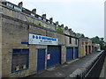
Garage industry on Midland Bridge Road, Bath
Image: © Richard Humphrey
Taken: 29 May 2017
0.01 miles
2
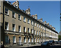
31-40 Green Park, Bath
The more modest of the street's two terraces (compare Image]), but not to be sniffed at by any means. The windows are cut into the walls without the mouldings evident in Bath's earlier terraces (e.g. Image]), but otherwise this adheres more to the Palladian tradition. Rusticated ground floor and continuous platband. By John Palmer, c1795. Grade II listed.
Image: © Stephen Richards
Taken: 25 May 2012
0.02 miles
3
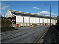
Bath Green Park Station
Former railway station
Image: © Chris Allen
Taken: 16 Feb 2014
0.03 miles
4
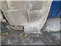
Ordnance Survey Cut Mark
This OS cut mark can be found on the garage on Midland Bridge Road. It marks a point 19.758m above mean sea level.
Image: © Adrian Dust
Taken: 3 Dec 2022
0.03 miles
6
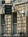
Detail of 23 Green Park, Bath
One of the fine iron overthrows has been put to a more modern use, to advertise the presence of the 'Trades & Labour Institute'.
Wider view: Image
An internet search suggests this is a nightclub, which doesn't seem very likely. In any case, the sign clearly pre-dates this.
Image: © Stephen Richards
Taken: 25 May 2012
0.04 miles
7

Narrow Lane in Bath
This is Parsonage Lane taken from inside the Royal National Hospital for Rheumatic Diseases BA1 1RL.
Image: © Rick Crowley
Taken: 19 Feb 2010
0.04 miles
8

Bath Green Park arrival
The 1.10pm from Bournemouth West arrives at its destination.
Image: © Martin Tester
Taken: 14 Aug 1963
0.04 miles
9

Bath Green Park departure
BR Standard 4 2-6-4T 80059 (built Brighton 3/53, withdrawn 11/65) waits with the 3.20pm to Templecombe. The fireman seems to be on top of the coal bunker, three young schoolboys look on.
Image: © Martin Tester
Taken: 15 Jun 1965
0.04 miles
10

Cut benchmark, Midland Bridge Road
A nicely sunlit cut mark on the upright of a double garage.
See Image] for a wider view, and http://www.bench-marks.org.uk/bm37655 for the Database.
Image: © Neil Owen
Taken: 12 Apr 2011
0.04 miles