IMAGES TAKEN NEAR TO
Shute Lane, BRUTON, BA10 0BN

Introduction

This page details the photographs taken nearby to Shute Lane, BA10 0BN by members of the Geograph project.

The Geograph project started in 2005 with the aim of publishing, organising and preserving representative images for every square kilometre of Great Britain, Ireland and the Isle of Man.

There are currently over 7.5m images from over14,400 individuals and you can help contribute to the project by visiting https://www.geograph.org.uk

Image Map


Images are licensed for reuse under creativecommons.org/licenses/by-sa/2.0
Notes
  • Clicking on the map will re-center to the selected point.
  • The higher the marker number, the further away the image location is from the centre of the postcode.

Image Listing (44 Images Found)

Images are licensed for reuse under creativecommons.org/licenses/by-sa/2.0
  • ...
Image
Details
Distance
1
Trendle Lane
An ancient lane running west from Bruton climbs up Trendle Hill. This view is looking east towards the town.
Image: © Graham Horn Taken: 4 May 2007
0.06 miles
2
Old Toll House, Bruton
Turnpike Cottage, Shute Lane, BA10 0BJ. Somerset HER. HER number: 45826 https://www.heritagegateway.org.uk/Gateway/Results_Single.aspx?uid=45826&resourceID=100 Surveyed Milestone Society National ID: SO.BRU02
Image: © Alan Rosevear Taken: 3 Sep 2009
0.11 miles
3
Row of houses, Tolbury Lane
Image: © Vieve Forward Taken: 18 Apr 2019
0.13 miles
4
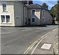
Shute Lane houses, Bruton
Near the corner of the A359 Cole Road.
Image: © Jaggery Taken: 17 Sep 2022
0.13 miles
5
Bruton Methodist Church, West End, Bruton
Listed Grade II, 19th century https://historicengland.org.uk/listing/the-list/list-entry/1346197?section=official-list-entry
Image: © Tim Heaton Taken: 2 Feb 2022
0.13 miles
6
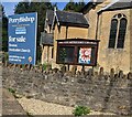
Boards outside Bruton Methodist Church
In September 2022 a For Sale board is alongside the church board.
Image: © Jaggery Taken: 17 Sep 2022
0.14 miles
7
Wyke Champflower direction sign, Shute Lane, Bruton
1½ miles from Wyke Champflower. The A359 is behind the camera.
Image: © Jaggery Taken: 17 Sep 2022
0.14 miles
8
SE side of Bruton Methodist Church
The church is for sale https://www.geograph.org.uk/photo/7286601 in September 2022.
Image: © Jaggery Taken: 17 Sep 2022
0.14 miles
9
'Chepstow House' at Shute Lane/Cole Road junction
There is an OS benchmark Image on the black-painted stones at the left hand front corner of the house.
Image: © Roger Templeman Taken: 24 Sep 2012
0.14 miles
10
Benchmark on 'Chepstow House'
Ordnance Survey cut mark benchmark described on the Bench Mark Database at http://www.bench-marks.org.uk/bm45520
Image: © Roger Templeman Taken: 24 Sep 2012
0.14 miles
  • ...