1
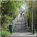
Play area in open space off Upper Field and Oldbury Closes, Church Hill, Redditch
The Worcestershire Arden landscape is still present in this district of the New Town.
Image: © Robin Stott
Taken: 1 May 2013
0.09 miles
2
Marlfield Lane, Church Hill, Redditch
The evocatively-named Marlfield Lane is a Worcestershire country lane that was incorporated into the New Town as a broad footpath linking residential closes in the Church Hill district. Parallel to it for some distance is Church Hill Way, a dedicated bus route.
Image: © Robin Stott
Taken: 1 May 2013
0.15 miles
3
Bus shelter on Paper Mill Drive
Bus shelter on Paper Mill Drive in the suburbs of Redditch.
Image: © Philip Halling
Taken: 28 Jul 2012
0.17 miles
4
Ryknild Street
The Roman Road, Ryknild Street, passing through a housing estate in the suburbs of Redditch.
Image: © Philip Halling
Taken: 28 Jul 2012
0.18 miles
5
The old line of Icknield Street, Church Hill, Redditch
Icknield or Ryknild Street was a Roman road running roughly north-south through the Midlands http://en.wikipedia.org/wiki/Icknield_Street It can be followed through Redditch.
Image: © Robin Stott
Taken: 1 May 2013
0.18 miles
6
Footbridge over Paper Mill Drive (B4497), Redditch
Image: © JThomas
Taken: 22 Jun 2019
0.18 miles
7
Footbridge over Paper Mill Drive, Church Hill, Redditch
The view is from the footpath across the end of Offenham Close. The footbridge leads to Paxford Close, Church Hill North. It has to be high enough to allow double-decker buses to pass beneath.
Image: © Robin Stott
Taken: 1 May 2013
0.19 miles
8
Church Hill centre, Redditch
The new town of Redditch was built as a series of distinct districts each with their own centre hub. These are the shops at the centre of the Church Hill district. As can be seen they are fitted with heavy shutters as these areas seem to attract unwelcome attention outside of trading hours!
Image: © David Stowell
Taken: 22 Apr 2006
0.20 miles
9
Gordon Anstis House, Redditch
The YMCA building in Church Hill, Redditch.
Image: © David Stowell
Taken: 22 Apr 2006
0.20 miles
10
Houses on Kimberley Close, Redditch
Image: © JThomas
Taken: 22 Jun 2019
0.22 miles


