IMAGES TAKEN NEAR TO
Blossomfield Road, SOLIHULL, B91 1NB

Introduction

This page details the photographs taken nearby to Blossomfield Road, B91 1NB by members of the Geograph project.

The Geograph project started in 2005 with the aim of publishing, organising and preserving representative images for every square kilometre of Great Britain, Ireland and the Isle of Man.

There are currently over 7.5m images from over14,400 individuals and you can help contribute to the project by visiting https://www.geograph.org.uk

Image Map


Images are licensed for reuse under creativecommons.org/licenses/by-sa/2.0
Notes
  • Clicking on the map will re-center to the selected point.
  • The higher the marker number, the further away the image location is from the centre of the postcode.

Image Listing (74 Images Found)

Images are licensed for reuse under creativecommons.org/licenses/by-sa/2.0
  • ...
Image
Details
Distance
1
Tudor Grange Leisure Centre, Blossomfield Road
Parkwood Leisure manage this centre on behalf of Solihull Metropolitan Borough Council. It has all the facilities you would expect, including a 25m swimming pool. Behind it is Tudor Grange Park, an informal recreation area for public use.
Image: © P L Chadwick Taken: 16 Oct 2010
0.08 miles
2
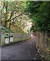
Footpath southeast from Solihull station subway, southwest end
It runs behind Dorchester Road to Blossomfield Road. It comes from Image
Image: © Robin Stott Taken: 9 Nov 2016
0.10 miles
3
Buses, Solihull railway station
Image: © Robin Stott Taken: 4 Dec 2009
0.10 miles
4
Railway Bridges over Blossomfield Road
A series of railway bridges cross the road at this point.
Image: © P L Chadwick Taken: 16 Oct 2010
0.11 miles
5
Solihull station
Sprinter unit no 150217 in a short lived "Central Trains" livery stands at the northbound platform.
Image: © Stephen Craven Taken: 31 Jul 2006
0.12 miles
6
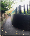
Footpath northwest from Solihull station subway, southwest end
At the far end it turns left for Dorchester Road. It comes from Image
Image: © Robin Stott Taken: 9 Nov 2016
0.12 miles
7
OS benchmark - Solihull, bridge south of station
An OS cutmark in the brick buttress of the bridge carrying the railway over Blossomfield Road; originally levelled at 124.21m above Ordnance Datum Newlyn.
Image: © Richard Law Taken: 16 Apr 2014
0.12 miles
8
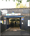
Subway, Solihull station, southwest end
The northeast end gives on to Station Approach. There are footpaths to left and right of the camera, see Image and Image
Image: © Robin Stott Taken: 9 Nov 2016
0.12 miles
9
Cast-iron columns, Solihull station: 2
Head of a cast-iron column that originally supported the screen to the door of the gentlemen's toilets: see Image The pair of columns were made by Lockerbie and Wilkinson of Tipton in the Black Country: http://www.locwil.com/history-of-locwil.html
Image: © Robin Stott Taken: 18 Oct 2011
0.12 miles
10
Cast-iron columns, Solihull station: 1
The pair of central columns of cast-iron are clearly older than the tubular steel supports for the platform canopy. Mike Westley's photo Image provides the answer: they supported the screen to the door of the gentlemen's toilet. They were made by Lockerbie & Wilkinson of Tipton in the Black Country.
Image: © Robin Stott Taken: 18 Oct 2011
0.12 miles
  • ...