1
St Mary the Virgin, Church Graveyard (8)
This photograph
Image shows another view of this Graveyard.
Image: © Chris' Buet
Taken: 26 Apr 2010
0.03 miles
2
Church of St Mary, Newton Regis
Tower and spire. The base of the tower is 13th century, the upper stages and spire being a mid 14th century heightening. Listed Grade II*.
Image: © Alan Murray-Rust
Taken: 11 Jun 2022
0.03 miles
3
Austrey Lane
Image: © Chris' Buet
Taken: 26 Apr 2010
0.03 miles
4
Church of St Mary, Newton Regis
The cramped churchyard makes it impossible to get a view of the complete church without a very wide angle lens.
The church consists of simple nave and chancel with west tower. Nave and chancel are 14th century, with the unusual feature of a clerestory added to both, despite the lack of aisles, in the late 15th century. The base of the tower is 13th century and likely to have been added to an earlier nave. Listed Grade II*.
Image: © Alan Murray-Rust
Taken: 11 Jun 2022
0.03 miles
5
Church of St Mary, Newton Regis
The 14th century tower and spire from the west. Listed Grade II*.
Image: © Alan Murray-Rust
Taken: 11 Jun 2022
0.04 miles
6
St Mary's Church, Newton Regis
Image: © JThomas
Taken: 23 May 2015
0.04 miles
7
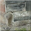
Bench mark, St Mary's Church, Newton Regis
See https://www.geograph.org.uk/photo/7201347 for location
Image: © Alan Murray-Rust
Taken: 11 Jun 2022
0.04 miles
8
Church of St Mary, Newton Regis
The base of the tower showing the battered reinforcement added in the 18th century. Judging by the later ties, there must always have been some doubt as to the stability of the tower. Listed Grade II*.
There is a benchmark https://www.geograph.org.uk/photo/7201327 just to the right of the corner buttress.
Image: © Alan Murray-Rust
Taken: 11 Jun 2022
0.04 miles
9
Newton Regis
The eastern end of the main street, with the spire of St Mary's Church.
Image: © Alan Murray-Rust
Taken: 11 Jun 2022
0.04 miles
10
Church of St Mary, Newton Regis
15th century south porch, probably added at the same time as the upper part of the nave wall.
Image: © Alan Murray-Rust
Taken: 11 Jun 2022
0.04 miles


