
IMAGES TAKEN NEAR TO
Lingard Road, SUTTON COLDFIELD, B75 7EA
Introduction
This page details the photographs taken nearby to Lingard Road, B75 7EA by members of the Geograph project.
The Geograph project started in 2005 with the aim of publishing, organising and preserving representative images for every square kilometre of Great Britain, Ireland and the Isle of Man.

There are currently over 7.5m images from over14,400 individuals and you can help contribute to the project by visiting https://www.geograph.org.uk
Image Map
Images are licensed for reuse under creativecommons.org/licenses/by-sa/2.0
Notes
- Clicking on the map will re-center to the selected point.
- The higher the marker number, the further away the image location is from the centre of the postcode.
Image Listing (8 Images Found)
Images are licensed for reuse under creativecommons.org/licenses/by-sa/2.0
Image
Details
Distance
1
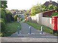
Gully, Reddicap Heath Road
Gully to Lingard Road and Jesson Road, almost opposite ROW to Stephens Road
Image: © Michael Westley
Taken: 15 May 2010
0.02 miles
2
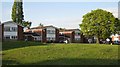
Stephens Road housing
Suburban housing on Stephens Road, Sutton Coldfield
Image: © Michael Westley
Taken: 15 May 2010
0.12 miles
3

John Willmott School playing fields
View from ROW between Reddicap Heath Road and Stephens Road
Image: © Michael Westley
Taken: 15 May 2010
0.13 miles
4
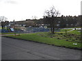
Play Area, Falcon Lodge
On Churchill Road. This grassy strip of land creates an open space on the estate. It also is the route of the stream that leads into Langley Brook beyond (culvert can just be seen on right).
Image: © Michael Westley
Taken: 12 Feb 2011
0.14 miles
6

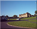
John Wilmott School
School on Reddicap Heath Road, Sutton Coldfield http://www.jws.bham.sch.uk/
Image: © Michael Westley
Taken: 15 May 2010
0.16 miles
7

Fairfax School, Sutton Coldfield
On Reddicap Heath Road, near to Fairfax Road http://vle.fairfax.bham.sch.uk/
Image: © Michael Westley
Taken: 15 May 2010
0.21 miles
8
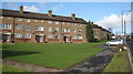
Falcon Lodge housing
Multi-storey flats (several blocks either side of Carhampton Road)
Image: © Michael Westley
Taken: 12 Feb 2011
0.24 miles