IMAGES TAKEN NEAR TO
Harvills Hawthorn, WEST BROMWICH, B70 0UH
Introduction
This page details the photographs taken nearby to Harvills Hawthorn, B70 0UH by members of the Geograph project.
The Geograph project started in 2005 with the aim of publishing, organising and preserving representative images for every square kilometre of Great Britain, Ireland and the Isle of Man.

There are currently over 7.5m images from over14,400 individuals and you can help contribute to the project by visiting https://www.geograph.org.uk
Image Map
Images are licensed for reuse under creativecommons.org/licenses/by-sa/2.0
Notes
- Clicking on the map will re-center to the selected point.
- The higher the marker number, the further away the image location is from the centre of the postcode.
Image Listing (23 Images Found)
Images are licensed for reuse under creativecommons.org/licenses/by-sa/2.0
Image
Details
Distance
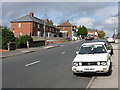
1
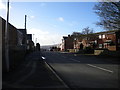
North end of Dial Lane, Harvills Hawthorn
Image: © Richard Vince
Taken: 9 Feb 2019
0.03 miles
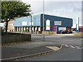
2
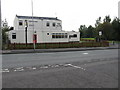
Industrial unit, Harvills Hawthorn
Apparently something to do with the automotive repair trade. Looking rather more modern than the adjacent building visible beyond.
Image: © Richard Vince
Taken: 9 Feb 2019
0.05 miles
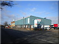
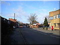
3
Global Cash and Carry
Close to the junction of New Street with Dial Lane.
Image: © Peter Whatley
Taken: 9 Oct 2008
0.06 miles
4
South end of Tunnel Road, Hill Top
Presumably so named because Hill Top Tunnel, a former railway tunnel now used by the Midland Metro tramway, is directly beneath. Seen from New Street.
Image: © Richard Vince
Taken: 9 Feb 2019
0.06 miles
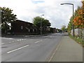
6
Harvills Hawthorn, Harvills Hawthorn
This road has the same name as the area through which it passes.
Image: © Richard Vince
Taken: 9 Feb 2019
0.09 miles
7
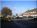
New Street, Hill Top
Looking towards Harvills Hawthorn from the end of Norbury Road.
Image: © Richard Vince
Taken: 9 Feb 2019
0.09 miles
9
The world is not enough.
The Globe - a derelict pub on New Street, near Hateley Heath.
Image: © Peter Whatley
Taken: 9 Oct 2008
0.13 miles
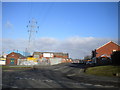
10
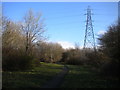
Footpath and pylon, Hill Top
In an open space behind Norbury Road.
Image: © Richard Vince
Taken: 9 Feb 2019
0.15 miles