IMAGES TAKEN NEAR TO
St. Pauls Crescent, WEST BROMWICH, B70 0TR
Introduction
This page details the photographs taken nearby to St. Pauls Crescent, B70 0TR by members of the Geograph project.
The Geograph project started in 2005 with the aim of publishing, organising and preserving representative images for every square kilometre of Great Britain, Ireland and the Isle of Man.

There are currently over 7.5m images from over14,400 individuals and you can help contribute to the project by visiting https://www.geograph.org.uk
Image Map
Images are licensed for reuse under creativecommons.org/licenses/by-sa/2.0
Notes
- Clicking on the map will re-center to the selected point.
- The higher the marker number, the further away the image location is from the centre of the postcode.
Image Listing (14 Images Found)
Images are licensed for reuse under creativecommons.org/licenses/by-sa/2.0
Image
Details
Distance
1
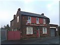
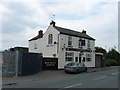
The Miners Arms
In a small community of mixed industrial and residential development. The pub name suggests this was originally a coal mining area and is typical for the Black Country.
Image: © John M
Taken: 7 Nov 2006
0.05 miles
2
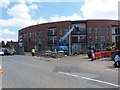
Construction work on Bagnall Street, Gold's Green
Part of a development of 106 homes in West Bromwich, for supported housing, general needs rent, rent to homebuy and 'intermediate market' (whatever that means!)
Image: © Richard Law
Taken: 27 Jul 2012
0.05 miles
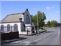
6
Triumphant Church of God
A Church in Harvills Hawthorn.
Image: © Gordon Griffiths
Taken: 29 Apr 2009
0.10 miles
7
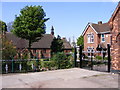
St Paul's Vicarage
The Vicarage stands alongside the Church on Bagnall Street.
Image: © Gordon Griffiths
Taken: 29 Apr 2009
0.10 miles
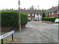
8
Harvills Hawthorn
A Street in Wednesbury.
Image: © Gordon Griffiths
Taken: 29 Apr 2009
0.11 miles
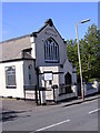
9
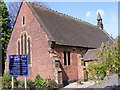
The Parish Church of St Paul
A Church on Bagnall Street.
Image: © Gordon Griffiths
Taken: 29 Apr 2009
0.13 miles
10
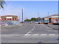
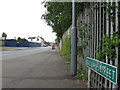
Shaw Street
A Street off Harvills Hawthorn, made up of Industrial estates.
Image: © Gordon Griffiths
Taken: 29 Apr 2009
0.13 miles