
IMAGES TAKEN NEAR TO
Hill Top, WEST BROMWICH, B70 0RT
Introduction
This page details the photographs taken nearby to Hill Top, B70 0RT by members of the Geograph project.
The Geograph project started in 2005 with the aim of publishing, organising and preserving representative images for every square kilometre of Great Britain, Ireland and the Isle of Man.

There are currently over 7.5m images from over14,400 individuals and you can help contribute to the project by visiting https://www.geograph.org.uk
Image Map
Images are licensed for reuse under creativecommons.org/licenses/by-sa/2.0
Notes
- Clicking on the map will re-center to the selected point.
- The higher the marker number, the further away the image location is from the centre of the postcode.
Image Listing (24 Images Found)
Images are licensed for reuse under creativecommons.org/licenses/by-sa/2.0
Image
Details
Distance
3
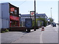
Fryday's Hill Top
The Fish and chip shop on the A4196.
Image: © Gordon Griffiths
Taken: 21 Apr 2009
0.09 miles
4
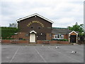
The Dovecote, Hill Top
Complete with doves
Image: © Alex McGregor
Taken: 25 May 2010
0.10 miles
5
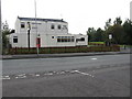
The world is not enough.
The Globe - a derelict pub on New Street, near Hateley Heath.
Image: © Peter Whatley
Taken: 9 Oct 2008
0.11 miles
6
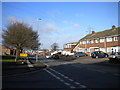
New Street, Hill Top
Looking towards Harvills Hawthorn from the end of Norbury Road.
Image: © Richard Vince
Taken: 9 Feb 2019
0.11 miles
7
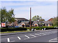
The Dovecote
A Pub on Hill Top road.
Image: © Gordon Griffiths
Taken: 21 Apr 2009
0.12 miles
8
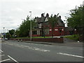
Hill Top, old police station
On Hill Top; former police station to left, sergeant's house to right. Dated 1897, now serving as community centre & library.
Image: © Mike Faherty
Taken: 8 Jun 2009
0.12 miles
9
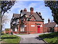
Hill Top Centre
The Community Centre and Library at Hill Top,West Bromwich.
Image: © Gordon Griffiths
Taken: 21 Apr 2009
0.13 miles
10
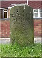
Old Milestone by the A4196, Hill Top, West Bromwich parish
Metal plate attached to stone post by the A4196 (was A41), in parish of WEST BROMWICH (SANDWELL District), Hill Top, by No. 136, on deep verge behind trees, on West side of road. Birmingham iron plate, erected by the Birmingham & Wednesbury turnpike trust in the 19th century.
Inscription reads:-
115
MILES FROM
LONDON
7 FROM
B(IRM)
6 (FROM)
W.HAMPTON
Grade II listed.
List Entry Number: 1216618 https://historicengland.org.uk/listing/the-list/list-entry/1216618
Milestone Society National ID: ST_BMWV07.
Image: © Mike Faherty
Taken: 11 Jun 2007
0.13 miles