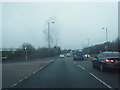
IMAGES TAKEN NEAR TO
Brickhouse Lane, WEST BROMWICH, B70 0EA
Introduction
This page details the photographs taken nearby to Brickhouse Lane, B70 0EA by members of the Geograph project.
The Geograph project started in 2005 with the aim of publishing, organising and preserving representative images for every square kilometre of Great Britain, Ireland and the Isle of Man.

There are currently over 7.5m images from over14,400 individuals and you can help contribute to the project by visiting https://www.geograph.org.uk
Image Map
Images are licensed for reuse under creativecommons.org/licenses/by-sa/2.0
Notes
- Clicking on the map will re-center to the selected point.
- The higher the marker number, the further away the image location is from the centre of the postcode.
Image Listing (6 Images Found)
Images are licensed for reuse under creativecommons.org/licenses/by-sa/2.0
Image
Details
Distance
1
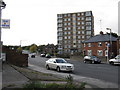
Block of flats off Dial Lane
Handy for the kebab shop!
Image: © Peter Whatley
Taken: 9 Oct 2008
0.05 miles
3

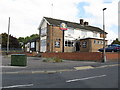
Harvills Hawthorn Primary School
True to its name, the school hides away behind a surrounding hawthorn hedge, and as a result it's quite hard to photograph (without trespassing on the grounds). The school was built in the early 1950s.
School website http://www.harvillshawthorn.ik.org/p_Harvills_Hawthorn_Primary_School_Website.ikml
Image: © Richard Law
Taken: 27 Jul 2012
0.18 miles
4
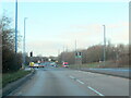
Pedestrian Crossing on the A41, West Bromwich
Image: © Roy Hughes
Taken: 5 Jan 2022
0.21 miles
5
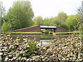
Ridgeacre Branch Canal
Sadly now separated from the rest of the canal network by a new spine road
Image: © Bill Payer
Taken: Unknown
0.22 miles