IMAGES TAKEN NEAR TO
Staulton Green, OLDBURY, B69 1AU

Introduction

This page details the photographs taken nearby to Staulton Green, B69 1AU by members of the Geograph project.

The Geograph project started in 2005 with the aim of publishing, organising and preserving representative images for every square kilometre of Great Britain, Ireland and the Isle of Man.

There are currently over 7.5m images from over14,400 individuals and you can help contribute to the project by visiting https://www.geograph.org.uk

Image Map


Images are licensed for reuse under creativecommons.org/licenses/by-sa/2.0
Notes
  • Clicking on the map will re-center to the selected point.
  • The higher the marker number, the further away the image location is from the centre of the postcode.

Image Listing (8 Images Found)

Images are licensed for reuse under creativecommons.org/licenses/by-sa/2.0
Image
Details
Distance
1
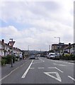
Blackheath Traffic Calming
The view in Throne Road.
Image: © Gordon Griffiths Taken: 3 Sep 2010
0.11 miles
2
Throne Road, Rowley Regis
Image: © JThomas Taken: 22 Aug 2019
0.14 miles
3
Footpath to Titford Pool
It often surprises me as I drive round Birmingham, how many of these inviting green walkways there are.
Image: © Antony Dixon Taken: 22 Apr 2015
0.15 miles
4
Shops on Throne Road, Rowley Regis
Image: © JThomas Taken: 22 Aug 2019
0.18 miles
5
Bus stop and shelter on Throne Road, Rowley Regis
Image: © JThomas Taken: 22 Aug 2019
0.19 miles
6
Birchfield Lane, Whiteheath
Looking towards Blackheath from opposite its junction with Borough Crescent.
Image: © Richard Vince Taken: 13 Nov 2021
0.23 miles
7
Footpath off Birchfield Lane, Whiteheath
Passing a pylon to reach the south western side of Titford Pool.
Image: © Richard Vince Taken: 13 Nov 2021
0.25 miles
8
The northern of the two Titford Pools
The pools are navigable canal reservoirs on the highest level of the BCN. Seen from a narrowboat.
Image: © Christine Johnstone Taken: 10 May 2022
0.25 miles