IMAGES TAKEN NEAR TO
Wilson Road, OLDBURY, B68 9JN
Introduction
This page details the photographs taken nearby to Wilson Road, B68 9JN by members of the Geograph project.
The Geograph project started in 2005 with the aim of publishing, organising and preserving representative images for every square kilometre of Great Britain, Ireland and the Isle of Man.

There are currently over 7.5m images from over14,400 individuals and you can help contribute to the project by visiting https://www.geograph.org.uk
Image Map
Images are licensed for reuse under creativecommons.org/licenses/by-sa/2.0
Notes
- Clicking on the map will re-center to the selected point.
- The higher the marker number, the further away the image location is from the centre of the postcode.
Image Listing (14 Images Found)
Images are licensed for reuse under creativecommons.org/licenses/by-sa/2.0
Image
Details
Distance
1
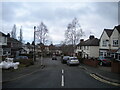
Warley Hall Road, Warley
Off Wilson Road.
Image: © Richard Vince
Taken: 3 Dec 2022
0.05 miles
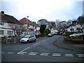
3
Lenwade Road, Warley
Leading from Hadzor Road to Harborne Road.
Image: © Richard Vince
Taken: 3 Dec 2022
0.08 miles
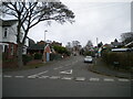
4
Harborne Road, Warley
Along the western edge of Warley Park.
Image: © Richard Vince
Taken: 3 Dec 2022
0.11 miles
5
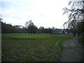
North end of Warley Woods golf course
Seen from the footpath leading from Harborne Road into Warley Park.
Image: © Richard Vince
Taken: 3 Dec 2022
0.15 miles

7
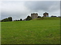
Warley covered Reservoir
Located on top of a substantial hill, the covered reservoir supplies water to the surrounding towns. And juding by the number of masts and antennae on the building at the back, the Severn Trent probably get a fair income from the telecoms companies too.
Image: © Richard Law
Taken: 2 Oct 2019
0.19 miles
8
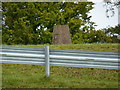
Warley Reservoir trig pillar
Located high on top of a covered reservoir, and quite effectively inaccessible (unless your stealth tactics are particularly good) this trig has a flush bracket levelled in 1956 at 236.613m above Ordnance Datum Newlyn.
Image: © Richard Law
Taken: 2 Oct 2019
0.20 miles
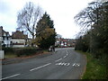
9
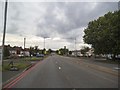
A4123 View
The view down the Wolverhampton Road towards the white cross on Our Lady and St Hubert Catholic Church in Warley, Sandwell.
Image: © Gordon Griffiths
Taken: 13 Sep 2015
0.21 miles
10
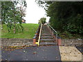
Steps from Castle Road East
Pedestrian steps down a bank from one road to another. The yellow rail appears to be a mechanism to allow bikes to be wheeled up or down without 'bouncing' on the steps; it was tempting to try rising the rail on the mountain bike, but then I realised that was a game for kids, not men in the late 50s, and decided better of it.
Image: © Richard Law
Taken: 2 Oct 2019
0.23 miles