IMAGES TAKEN NEAR TO
Kinsey Road, SMETHWICK, B66 4SN
Introduction
This page details the photographs taken nearby to Kinsey Road, B66 4SN by members of the Geograph project.
The Geograph project started in 2005 with the aim of publishing, organising and preserving representative images for every square kilometre of Great Britain, Ireland and the Isle of Man.

There are currently over 7.5m images from over14,400 individuals and you can help contribute to the project by visiting https://www.geograph.org.uk
Image Map
Images are licensed for reuse under creativecommons.org/licenses/by-sa/2.0
Notes
- Clicking on the map will re-center to the selected point.
- The higher the marker number, the further away the image location is from the centre of the postcode.
Image Listing (29 Images Found)
Images are licensed for reuse under creativecommons.org/licenses/by-sa/2.0
Image
Details
Distance
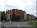
2
Lonely remains of Cape Hill Brewery
Sadly no one had Geographed this site earlier as this is almost all that now remains of the once extensive Cape Hill Brewery built by Mitchells and Butlers in 1898. It was one of the largest cask ale breweries in the country. The Brewery was taken over by the American Coors company in February 2002, who then announced its closure by the end of the year and moved the brewing to Burton-on-Trent. In June 2004 Coors announced the sale of the site and demolition commenced in mid 2005. It would have been possible to have taken a Geograph in the early days of this website before the Brewery was systematically reduced to current forlorn pile of rubble.
Image: © David Stowell
Taken: 2 Jul 2006
0.03 miles
3
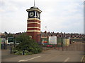
Clock Tower at the entrance to Cape Hill Brewery
Image: © David Stowell
Taken: 2 Jul 2006
0.03 miles
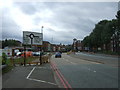
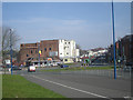
4
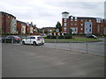
Cape Hill roundabout
The A457 Grove Lane heads left as the Dudley Road here, and is joined by the A4092 Cape Hill road from the right.
Image: © Richard Law
Taken: 26 Jun 2017
0.04 miles
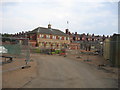
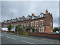
6

Mitchells & Butlers War Memorial and Office block
This used to be the Fire Station for Mitchells & Butlers Brewery. I worked (or at least made up the numbers) for three years in the office block next to this building - the office block no longer exists. Behind me would have been the loading bays for the drays that carried the beer over all of the west Midlands. How things change - and not always for the better.
Image: © Row17
Taken: 20 Mar 2009
0.07 miles
8
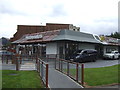
Grove Lane, Smethwick
The A457 approaching a roundabout.
Image: © JThomas
Taken: 22 Aug 2019
0.08 miles
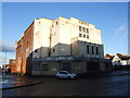
10
The 'old' Grove cinema
The boundary between Smethwick and Birmingham. The large building was The Grove cinema & is in Birmingham. The strange and totally unappetising franchise fast something centre is on the site of the once glorious pub called 'The Cape of Good Hope' - let's have the pub back!
Image: © Row17
Taken: 20 Mar 2009
0.09 miles