IMAGES TAKEN NEAR TO
Woodlands Street, SMETHWICK, B66 3TF
Introduction
This page details the photographs taken nearby to Woodlands Street, B66 3TF by members of the Geograph project.
The Geograph project started in 2005 with the aim of publishing, organising and preserving representative images for every square kilometre of Great Britain, Ireland and the Isle of Man.

There are currently over 7.5m images from over14,400 individuals and you can help contribute to the project by visiting https://www.geograph.org.uk
Image Map
Images are licensed for reuse under creativecommons.org/licenses/by-sa/2.0
Notes
- Clicking on the map will re-center to the selected point.
- The higher the marker number, the further away the image location is from the centre of the postcode.
Image Listing (24 Images Found)
Images are licensed for reuse under creativecommons.org/licenses/by-sa/2.0
Image
Details
Distance
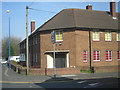
1
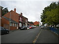
Woodland Street
Looking West up Woodland Street
Image: © planetearthisblue
Taken: 27 Sep 2015
0.10 miles
2
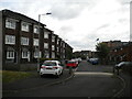
Cuin Road, Smethwick
Off St Matthews Road.
Image: © Richard Vince
Taken: 11 Sep 2021
0.11 miles
3
Brindley Way, Smethwick
A residential footpath off St Matthews Road.
Image: © Richard Vince
Taken: 11 Sep 2021
0.11 miles
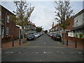
4
St Matthews Road, Smethwick
Seen from its junction with Cuin Road.
Image: © Richard Vince
Taken: 11 Sep 2021
0.12 miles
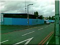
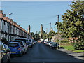
7
Trafalgar Road, Smethwick
Off Durban Road.
Image: © Richard Vince
Taken: 11 Sep 2021
0.19 miles
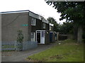
8
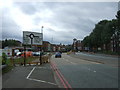
Grove Lane, Smethwick
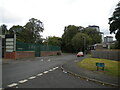
The A457 approaching a roundabout.
Image: © JThomas
Taken: 22 Aug 2019
0.19 miles
9
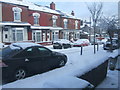
Trafalgar Road in the snow
Too snowy to go to work!
Image: © Ruth Riddle
Taken: 6 Jan 2010
0.19 miles