IMAGES TAKEN NEAR TO
Ramila Close, SMETHWICK, B66 1RF

Introduction

This page details the photographs taken nearby to Ramila Close, B66 1RF by members of the Geograph project.

The Geograph project started in 2005 with the aim of publishing, organising and preserving representative images for every square kilometre of Great Britain, Ireland and the Isle of Man.

There are currently over 7.5m images from over14,400 individuals and you can help contribute to the project by visiting https://www.geograph.org.uk

Image Map


Images are licensed for reuse under creativecommons.org/licenses/by-sa/2.0
Notes
  • Clicking on the map will re-center to the selected point.
  • The higher the marker number, the further away the image location is from the centre of the postcode.

Image Listing (153 Images Found)

Images are licensed for reuse under creativecommons.org/licenses/by-sa/2.0
  • ...
Image
Details
Distance
1
Holly Lane, Smethwick
Image: © Chris Whippet Taken: 22 Dec 2013
0.03 miles
2
Galton Bridge
Built in 1826 by Thomas Telford. When built it was the longest single span iron bridge in the world.
Image: © Alan Atkins Taken: 30 Aug 2005
0.05 miles
3
Galton Bridge sign
The sign is at the start of the bridge, near the dual carriageway Oldbury Road (the A457). The sign was placed here in 2008 by the Hadley Group, who are one of Europe's largest privately owned cold-rolled steel manufacturers. They are based in and around Smethwick. Image
Image: © P L Chadwick Taken: 16 Aug 2010
0.05 miles
4
Draycott Road, Smethwick
Image: © Chris Whippet Taken: 22 Dec 2013
0.05 miles
5
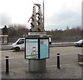
Information boards and artwork outside Smethwick Galton Bridge railway station
The artwork named Moontrap was designed by the Renn and Thacker Partnership LLP in 2003. The sculpture is based upon the reflection of both the moon and Thomas Telford's nearby Galton Bridge upon the canal below. When built in 1829 the bridge's single span of 151 feet was the highest in the world. Moontrap was made from laser-cut brushed stainless steel by Form Fabrications Ltd.
Image: © Jaggery Taken: 23 Jan 2018
0.05 miles
6
Flats on Holly Lane, Smethwick
Image: © JThomas Taken: 22 Aug 2019
0.06 miles
7
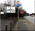
Oldbury Road directions signs, Smethwick
The posts are at the southern end of Thomas Telford's 1829 Galton Bridge. https://www.geograph.org.uk/photo/5660731
Image: © Jaggery Taken: 23 Jan 2018
0.06 miles
8
Canal Cycleway direction and distances sign, Smethwick
Located on the left here, https://www.geograph.org.uk/photo/5660751 at the southern end of Thomas Telford's 1829 Galton Bridge. https://www.geograph.org.uk/photo/5660731
Image: © Jaggery Taken: 23 Jan 2018
0.06 miles
9
Across Galton Bridge, Smethwick
The bridge carries Roebuck Lane over the Birmingham Canal. Originally a road bridge, now restricted to pedestrians and cyclists.
Image: © Jaggery Taken: 23 Jan 2018
0.06 miles
10
Smethwick Galton Bridge railway station name sign
Alongside the A457 Oldbury Road.
Image: © Jaggery Taken: 23 Jan 2018
0.06 miles
  • ...