IMAGES TAKEN NEAR TO
Sugarbrook Road, BROMSGROVE, B60 3DW
Introduction
This page details the photographs taken nearby to Sugarbrook Road, B60 3DW by members of the Geograph project.
The Geograph project started in 2005 with the aim of publishing, organising and preserving representative images for every square kilometre of Great Britain, Ireland and the Isle of Man.

There are currently over 7.5m images from over14,400 individuals and you can help contribute to the project by visiting https://www.geograph.org.uk
Image Map
Images are licensed for reuse under creativecommons.org/licenses/by-sa/2.0
Notes
- Clicking on the map will re-center to the selected point.
- The higher the marker number, the further away the image location is from the centre of the postcode.
Image Listing (71 Images Found)
Images are licensed for reuse under creativecommons.org/licenses/by-sa/2.0
Image
Details
Distance
2
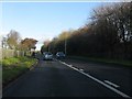
A38 north of Bromsgrove Technology Park
An uncharacteristically open section of Bromsgrove's bypass north of Sugar Brook.
Image: © Peter Whatley
Taken: 27 Nov 2011
0.08 miles
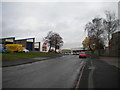
3
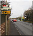
Stoke Road direction signs, Bromsgrove
Facing the A38 Stoke Road. For Finstall and Bromsgrove railway station, turn right ahead at the junction where the A38 Stoke Road becomes the unclassified Stoke Road in the Aston Fields area of Bromsgrove.
Image: © Jaggery
Taken: 3 Dec 2016
0.09 miles
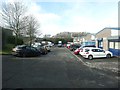
4
Access road off Sherwood Road, Aston Fields business park
Image: © Richard Vince
Taken: 1 Dec 2018
0.10 miles
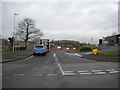
5
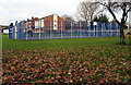
Multi-use sports court, Bromsgrove
Located between Stoke Road (on this side) and Lyttleton Avenue.
Image: © Jaggery
Taken: 3 Dec 2016
0.10 miles
6
Summit of Sherwood Road, Aston Fields business park
Image: © Richard Vince
Taken: 1 Dec 2018
0.10 miles
7
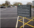
Safety notice in Brook Retail Park car park, Bromsgrove
The notice in this http://www.geograph.org.uk/photo/5248436 car park shows that the area is subject to flooding and gives instructions to follow when flooding occurs.
Image: © Jaggery
Taken: 3 Dec 2016
0.11 miles
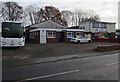
8
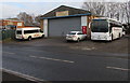
Bromsgrove Bus & Coach Co Ltd, Bromsgrove
At 7 Sherwood Road.
Image: © Jaggery
Taken: 3 Dec 2016
0.11 miles
9
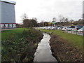
Sugar Brook flows through Brook Retail Park, Bromsgrove
Notices http://www.geograph.org.uk/photo/5248441 in the car park on the right show that this area is liable to flooding.
Image: © Jaggery
Taken: 3 Dec 2016
0.11 miles
10
Colour 24, Bromsgrove
Design & print shop in Nova House, Sherwood Road.
Image: © Jaggery
Taken: 3 Dec 2016
0.11 miles