IMAGES TAKEN NEAR TO
B5 7QY

Introduction

This page details the photographs taken nearby to B5 7QY by members of the Geograph project.

The Geograph project started in 2005 with the aim of publishing, organising and preserving representative images for every square kilometre of Great Britain, Ireland and the Isle of Man.

There are currently over 7.5m images from over14,400 individuals and you can help contribute to the project by visiting https://www.geograph.org.uk

Image Map


Images are licensed for reuse under creativecommons.org/licenses/by-sa/2.0
Notes
  • Clicking on the map will re-center to the selected point.
  • The higher the marker number, the further away the image location is from the centre of the postcode.

Image Listing (165 Images Found)

Images are licensed for reuse under creativecommons.org/licenses/by-sa/2.0
  • ...
Image
Details
Distance
1
Construction to west of Edgbaston Cricket Ground
This image is captured from the main entrance of the cricket ground, currently operating as a major Covid vaccination centre. Construction began recently on the plot between the stadium and Pershore Road. In use as a temporary car park for the last few years, the site was previously mainly occupied by a row of houses fronting into Pershore Road.
Image: © Paul Collins Taken: 22 May 2021
0.03 miles
2
Crossroads, Edgbaston
The view is south on the A441 Pershore Road where it crosses the B4217 Edgbaston Road, left, and Priory Road, right.
Image: © Robin Stott Taken: 12 Sep 2022
0.04 miles
3
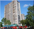
Flats, Pershore Road
Block of flats at junction of Pershore Road and Edgbaston Road
Image: © Michael Westley Taken: 31 May 2011
0.05 miles
4
The approach to Edgbaston Cricket Ground during the 2022 Commonwealth Games
Women's cricket featured here for the first time in these, or any similar, Games. See Image
Image: © Ruth Sharville Taken: 6 Aug 2022
0.05 miles
5
Towerblock, Pershore Rd
Image: © N Chadwick Taken: 11 Jun 2011
0.05 miles
6
Houses on Wyatt Road, Edgbaston
Image: © JThomas Taken: 22 Jul 2017
0.06 miles
7
Aldi supermarket, Edgbaston
Serving flat-dwellers and cricket fans alike. The roof sports a big HOWZAT!
Image: © Robin Stott Taken: 12 Sep 2022
0.06 miles
8
Junction, Queens Ride and Edgbaston Road
View from grassy bank beside entrance to Cannon Hill Park car park. Looking towards flats that are situated between Pershore Road and Bristol Road
Image: © Michael Westley Taken: 28 May 2010
0.06 miles
9
Aldi supermarket, Edgbaston
Serving nearby flat-dwellers and cricket fans alike. The roof shouts HOWZAT! in big letters.
Image: © Robin Stott Taken: 12 Sep 2022
0.07 miles
10
West end of Edgbaston Road
At its junction with Pershore Road.
Image: © Robin Stott Taken: 6 Oct 2010
0.07 miles
  • ...