IMAGES TAKEN NEAR TO
Lilley Green Road, BIRMINGHAM, B48 7JJ
Introduction
This page details the photographs taken nearby to Lilley Green Road, B48 7JJ by members of the Geograph project.
The Geograph project started in 2005 with the aim of publishing, organising and preserving representative images for every square kilometre of Great Britain, Ireland and the Isle of Man.

There are currently over 7.5m images from over14,400 individuals and you can help contribute to the project by visiting https://www.geograph.org.uk
Image Map
Images are licensed for reuse under creativecommons.org/licenses/by-sa/2.0
Notes
- Clicking on the map will re-center to the selected point.
- The higher the marker number, the further away the image location is from the centre of the postcode.
Image Listing (15 Images Found)
Images are licensed for reuse under creativecommons.org/licenses/by-sa/2.0
Image
Details
Distance
3
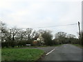
Watery Lane Near Birch Acre Farm & Lilley Green Road
Image: © Roy Hughes
Taken: 2 Jan 2019
0.08 miles
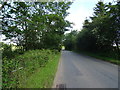
4
Country lane
Heading towards Weatheroak.
Image: © Mike Dodman
Taken: 7 Nov 2009
0.11 miles
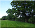
5
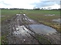
Arable land at Birch Acre
The track crossing the field is marked on the OS map.
Image: © Philip Halling
Taken: 19 Jan 2018
0.12 miles
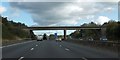
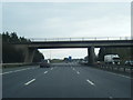
6
Eastbound M42, Lilley Green Road Bridge
Image: © David Dixon
Taken: 25 Jul 2018
0.23 miles
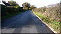
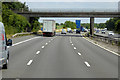
7
Approaching the bridge over M42 near Moorfield Farm
Image: © David Smith
Taken: 16 Oct 2012
0.23 miles
8
M42 Motorway - overbridge near Moorfield Farm
Image: © J Whatley
Taken: 21 Apr 2010
0.24 miles
9
M42 nearing Lilley Green Road overbridge
Image: © Colin Pyle
Taken: 27 Feb 2016
0.24 miles
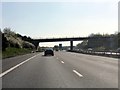
10
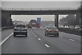
Bromsgrove : The M42 Motorway
About to head under the bridge here on the M42 motorway in the Bromsgrove district of Worcestershire.
Image: © Lewis Clarke
Taken: 6 Feb 2012
0.24 miles